 Trails and pilgrimage routes
Emilia Romagna has always been a land of passage. Thanks to its central position, it has always been an obligatory stop for travellers, merchants and pilgrims crossing Europe and the Mediterranean.
Moreover, thanks to its ancient Catholic tradition, Emilia Romagna is criss-crossed by numerous roads that once ran between abbeys, cathedrals and ancient places of worship.

Today, all these routes are paths on a Route Planner that leads to the soul of the territory, destinations for naturalistic and religious tourism where art, sustainability and tradition of the region are the focal point.
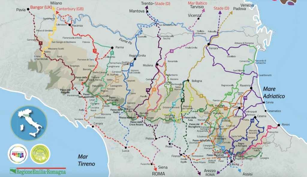
The Route Planner Cammini Emilia-Romagna offers the chance to travel 21 ancient routes, characterized by a strong spiritual, historical and naturalistic value.
These Routes are all mapped and signposted with specific directions and are: the Via Francigena, recognised today by the European Council as a cultural itinerary; the Via Romea Germanica and Germanica Imperiale, the Via Romea Nonantolana and Romea Longobarda, ancient European pilgrimage routes to Rome; the Via degli Abati, which retraces the routes followed by the Abbots to cross the Apennines; the Cammino di Sant’Antonio, the Cammino di Assisi, the Cammino di San Vicinio, the Cammino di San Francesco and the Cammino di San Colombano, linked to places characterised by the lives of saints; the Via degli Dei, which connects Bologna to Florence; the Via Mater Dei, which is the path of the Marian Sanctuaries in the Apennines between Bologna and Tuscany; the Via della Lana e della Seta, which connects Bologna to Prato; the Sentiero di Matilde di Canossa, which connects the Reggio Emilia Apennines to Tuscany; the Sentiero dei Ducati, which crosses the ancient Duchies of Modena and Reggio Emilia; the Piccola Cassia, one of the many paths leading to Rome joining the Via Francigena; the Via di Linari, in the territory of Parma; the Cammino di Dante, connecting Ravenna to Florence; the Viae Misericordiae, connecting the Pomposa Abbey to the Hermitage of Gamogna; the Alta Via dei Parchi, winding along the Apennine ridge between Emilia-Romagna and Tuscany.
Abbots Way
Stages in Emilia-Romagna: 6
Length in Emilia-Romagna: 127 Km
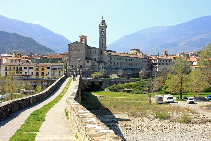
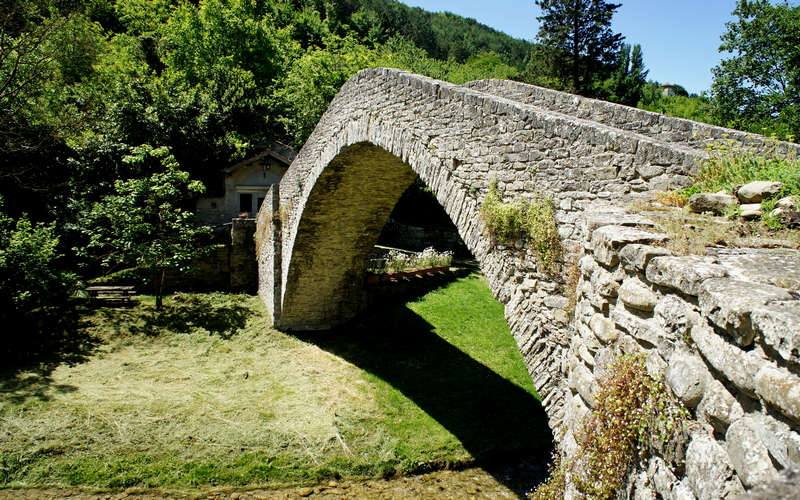
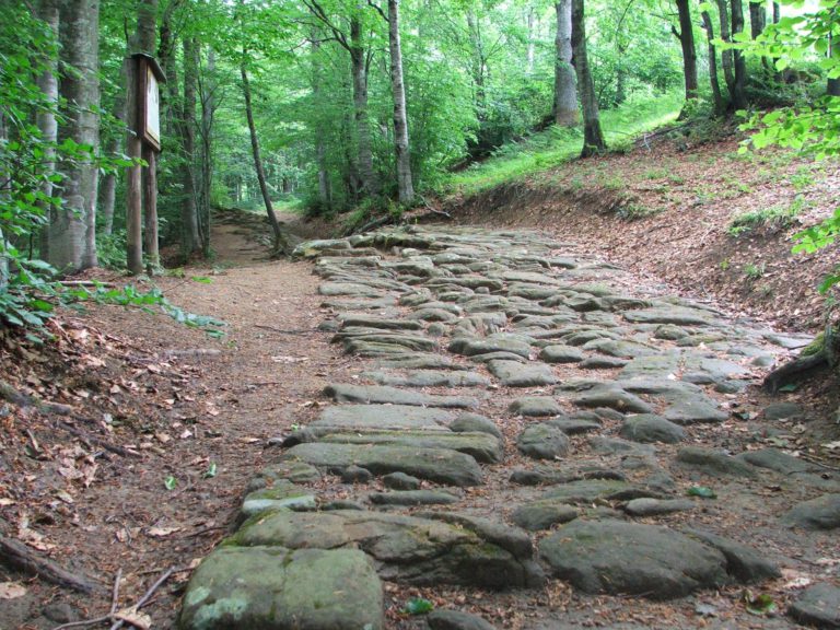
Opened by the monks of Bobbio who traveled it as a safe route between the cities of Pavia and Rome; the Abbots Way was closely connected with the monasteries of Gravago, Corte Torresana and San Giovanni in Pontremoli, and allowed complete control of both travellers and caravans to and from Rome across the northern Apennines.
The route was also used by Irish pilgrims who on their way to Rome included a stop in Bobbio to pray at the tomb of St. Columbanus, the Irish abbot who founded the local abbey.
Route Planner
Francigena Way
Stages in Emilia-Romagna: 6
Length in Emilia-Romagna: 143 Km
The Francigena Way is a long European itinerary that starts in Canterbury and arrives at the tomb of St Peter in Rome, crossing four countries and thirteen European regions.
It originated as a detailed travel report in the 10th century A.D. written by Bishop Sigeric and, like all great communication routes, it has seen a constant flow of pilgrims over the centuries, making it both a privileged place of communication between the different European cultures and the cultural, artistic and economic forge of modern Europe.
In the Emilia-Romagna stretch, the Via Francigena passes through some villages of great historical and spiritual value, such as Berceto.
Route Planner
Linari Way
Stages in Emilia-Romagna: 8
Length in Emilia-Romagna: 110 Km
The Linari Way was originally founded as a safe detour from the Francigena Way through the Lagastrello Pass and took its name from the Abbey of the same name located on the ridge between Tuscany and Emilia Romagna.
Route Planner
Matilda's Way
Stages in Emilia-Romagna: 8
Length in Emilia-Romagna: 140 Km
The Matilda’s Way retraces the ancient itineraries that crossed Northern Italy within the ancient kingdom of the Countess Matilde di Canossa. In these lands one can still read the marks left by Matilda and her ancestors, among villages, ancient and strategic castles, in a unique cultural and natural variety.
The Matilda’s Way today links Mantua, UNESCO city and birthplace of the Countess, to Lucca, crossing the villages of Guastalla and Gualtieri, now included in the list of the most beautiful villages Italy. The route passes through the town of Reggio Emilia, the Canossa and Carpineti Castles and the Tuscan-Emilian Apennines National Park.
The trail then descends towards the Tuscan hills of Garfagnana, to finally reach the Tuscan city of Lucca.
Route Planner
Romea Nonantolana Way
Stages in Emilia-Romagna: 5 or 6, depending on the variant
Length in Emilia-Romagna: 207 Km
The Romea Nonantolana Way owes its name to the Abbey of Nonantola, starting point of the Way, and is now part of the European’s Routes project, a European network of history, culture, and tourism.
The Romea Nonantolana Way is divided into two distinct paths: the western route, which runs along the left bank of the Panaro river, and the eastern route, which runs, instead, along the right bank.
Both tracks start from Nonantola and rejoin in Fanano and then continue towards the pass of Croce Arcana.
The route of the Romea Nonantolana Way joins with the Romea Strata Way (only in the Emilia Romagna stretch), which from the northeast of Italy goes all the way to Rome joining with the Francigena Way, in the village of Fucecchio – Tuscany.
Route Planner
Romea Strata Longobarda Nonantolana Way
Stages in Emilia-Romagna: 8
Length in Emilia-Romagna: 186 Km
The name Longobarda Romea Strata Way once referred to a series of ancient itineraries that from Central Eastern Europe reached the borders of the Italian peninsula.
The route was made up of several tracks, so it was usually divided into seven different small paths that joined together in Emilia Romagna at the height of Badia Polesine. Regarding the Emilia-Romagna stretch, the Via Romea Strata is also called Romea Longobarda -Nonantolana, as it joins the Via Romea Nonantolana for a long stretch, crossing some important pilgrimage destinations such as the Modena Cathedral, the Nonantola Abbey, and the Fanano Pilgrims’ Hostel.
After crossing the Apennine ridge, Via Romea Longobarda descends towards Pistoia and San Miniato, where it joins the Francigena Way.
Route Planner
Piccola Cassia Way
Stages in Emilia-Romagna: 6
Length in Emilia-Romagna: 113 Km
The Piccola Cassia Way is an ancient road of Roman origin, northwards of the most famous Via Cassia, crossing the mountains between Modena and Bologna. Its origins date back to the times of Roman conquest and expansion in the Po Valley with the consequent foundation of new colonies and the reorganization of the existing road system.
The itinerary of the Piccola Cassia Way, which is still unchanged, originates from the south gate of the city of Modena and continues along the ridge between the Panaro valley and the Samoggia valley in the direction of the villages of Zocca and Castel d’Aiano, where it enters the Reno Valley.
After the Apennines, the route descends into Tuscany and finally reaches Pistoia, where it joins the Via Cassia in the direction of Rome.
Route Planner
The Way of the Gods
Stages in Emilia-Romagna: 3
Length in Emilia-Romagna: 67 Km
Traced originally around the VII-IV century A.C., the Way of Gods owes its definitive layout to the work of Roman engineering.
With the fall of the Roman Empire, the road lost part of the original paving and was reduced to a small path. With the advent of modern roads, it definitively lost its function; then, thanks to the work of a group of passionate hikers, the ancient route was rediscovered in the 80s. This road owes its name to the mountains that rise along its path, such as Adone Mount, Venus Mount, and Juno Mount.
Today the Way of the Gods is an extraordinary, well-equipped path that winds through the most evocative landscapes of the Tuscan-Emilian Apennines, connecting the cities of Bologna and Florence. The Way of the Gods is usually accessible to non-experts as well.
Route Planner
St. Anthony's Walk
Stages in Emilia-Romagna: 13
Length in Emilia-Romagna: 258 Km
St. Anthony’s Walk unwinds between Veneto, Emilia Romagna, and Tuscany along the routes that at the beginning of the XII century were travelled by one of the most loved and venerated saints of all of Christendom, St. Anthony.
Starting from Camposampiero in the province of Padova, the itinerary makes its way southward for over 400 km, entering Emilia-Romagna through the ford on the Po River in Ferrara and reaching the Sanctuary of San Luca in Bologna.
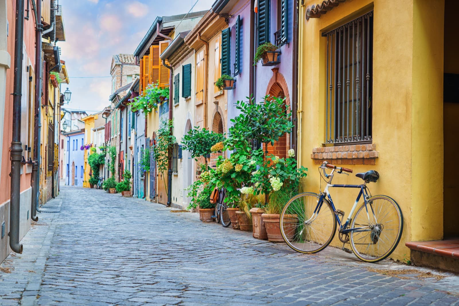
The route then passes through some small villages such as Dozza – the “painted village” and the headquarters of the Regional Enoteca – before entering the Casentino Park, which was declared a Unesco Natural reserve.
The path then leads to the Hermitage of Montepaolo, an important Antonian shrine in Emilia Romagna and the first Italian residence – 1221 and 1222 – of Saint Anthony, who lived here after meeting Saint Francis in Assisi.
Route Planner
Romea Germanica Way
Stages in Emilia-Romagna: 11
Length in Emilia-Romagna: 260 Km
The Romea Germanica Way originated in the 13th century as a transcription of the route taken by the monk Albert of Stade to reach the city of Rome in 1236, and was one of the ‘Peregrinationes Majiores’ that pilgrims, kings and emperors from northern Europe used to cross the continent to reach the papal city.
The route still passes through some of the symbolic sites of Christianity. From Ausburg, where the schism of 1517 was defined, it passes through Trento, the city of the Counter-Reformation, and Padua; it enters Emilia Romagna, at the height of the Ferrara area, where it is possible to follow some variants, and arrives in Byzantine Ravenna.
Once in the Apennines, the Romeo route climbs towards Bagno di Romagna and the Serra Pass, from where it descends towards Tuscany and ends in Rome.
Route Planner
Dante’s Walk
Stages in Emilia-Romagna: 13
Length in Emilia-Romagna: 194 Km
Dante’s Walk is a circular route between the Romagna area and the Casentino that retraces the steps of Dante Alighieri during his exile at the beginning of the XII century between the cities of Ravenna and Florence. The path is immersed in nature and it runs along ancient “crest” paths of Etruscan-Roman origin, away from traffic and busy streets.
The Route has its starting point at Dante’s tomb in Ravenna and finishes at the Museo Casa di Dante in Florence, crossing along its path the places of Dante’s exile, mentioned by the poet in many passages of the Divine Comedy.
Route Planner
Assisi Way
Stages in Emilia-Romagna: 4
Length in Emilia-Romagna: 72 Km
The Assisi Way is the result of the conjuction of many small pilgrimage routes dating back centuries, now united in a single great route that focuses on the figures of St. Anthony and St. Francis.
The route winds its way from Dovadola to Assisi and represents an authentic immersion in the historical and naturalistic dimension of the Romagna Apennines.
The whole Assisi Way was conceived on the basis of symbolic places linked to the essence of pilgrimage itself and to the two saints Anthony and Francis. The route passes through well-known places such as Assisi, La Verna (the sacred mountain of the stigmata), Gubbio, Montecasale and other Franciscan centres of religious importance such as the hermitage of Casella, and the thousand-year-old hermitage of Camaldoli, founded by St. Romuald of Ravenna.
Along the way, the path gives access to the Parco delle Foreste Casentinesi, now a Unesco World Heritage Site.
Route Planner
Saint Vicinius Way
Stages in Emilia-Romagna: 12
Length in Emilia-Romagna: 210 Km
The San Vicinius Way is one of the oldest historical Italian roads and it develops on a circular route that stretches for almost 350 kilometers between the provinces of Forlì–Cesena, Arezzo, and Rimini, overlapping the ancient Roman road system.
The route is inspired by the ancient Rome-Arezzo-Ravenna axis and passes through some of the most important natural environments in central-northern Italy, such as the Parco delle Foreste Casentinesi.
It also allows you to visit some of the great centres of Christian spirituality, such as the Madonna del Monte in Cesena, the Basilica of San Vicinio in Sarsina, the Sanctuary of La Verna, the “Volto Santo” in Borgo San Sepolcro in Tuscany and the cultural and spiritual centre of the Hermitage of Camaldoli.
Route Planner
Saint Francis’s walk from Rimini to La Verna
Stages in Emilia-Romagna: 5
Length in Emilia-Romagna: 98 Km
Inaugurated in 2013, St. Francis’s walk from Rimini to La Verna retraces some of the places visited by Saint Francis on his journey through Valmarecchia in 1213.
The path is dotted with convents and sacred settlements, such as that of the Poor Clares and the Friars Minor in Sant’Agata Feltria and the convent of Sant’Igne, built-in 1244 in the woods at the foot of the cliff of San Leo.
Like many routes in this area, the St. Francis walk retraces the ancient Italian road systems and joins up at La Verna with the articulated paths of Central Italy to finally reach Rome.
Route Planner
Wool and Silk Road
Stages in Emilia-Romagna: 4
Length in Emilia-Romagna: 69 Km
This ancient route connects Bologna and Prato, two cities rich in history that have prospered over the centuries thanks to the harnessing of their rivers.
Bologna, with its dam on the Reno river and its canals, was considered the capital of silk for centuries, while Prato was the city of the ancient dam, the canals and the mills of Cavalciotto, as well as its tradition in wool processing.
An evocative itinerary that can be followed all year round, but we recommend caution during the winter months.
Route Planner
Viae Misericordiae
Stages in Emilia-Romagna: 12
Length in Emilia-Romagna: 225 Km
From the Pomposa Abbey to the Hermitage of Gamogna (Apennines of Tuscany-Romagna), this circular route passes through the art cities of Comacchio, Faenza and Bagnacavallo and travels across lands rich in faith, culture, art, natural and fluvial parks, as well as a welcoming community and food and wine specialties.
Route Planner
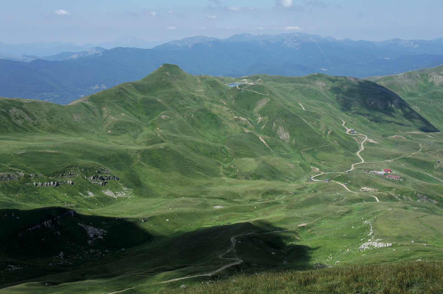
Alta Via - The Great Parks Trail
Stages in Emilia-Romagna: 27
Length in Emilia-Romagna: 493 Km
This route is a long multi-day itinerary that runs along the suggestive mountain ridge that divides the regions of Liguria, Tuscany, Emilia-Romagna, and Marche.
It comprises 27 high-altitude stages and takes you across two National parks, five regional parks and one interregional park in territories with great environmental, natural and cultural value.
The best time of the year to walk the entire path is from June to October, but the stretch within the Vena del Gesso Romagnola Regional Park and the Foreste Casentinesi National Park can be walked during the rest of the year as well.
Route Planner
The Romea Germanica Imperial Route
Stages in Emilia-Romagna: 8
Length in Emilia-Romagna: 160 Km
The Romea Germanica Imperial Route is a path that connects the city of Trento with the city of Arezzo passing through Modena, and it is part of the ancient system of Germanic streets leading to Rome.
In the past, it was a very popular road for military, religious and commercial needs as it connected the Alpine passes, the passes of the Apennines and the south of the Italian peninsula.
The north-south road network on which it runs has always been an important communication route between Europe and the Mediterranean and has been used in both directions since the time of the Celts, the Etruscans and then the Romans. It was precisely from this route that the Lombards, Franks and Germans arrived in Italy in the Middle Ages.
From the 18th century onwards, it became the most important route between Italy and Europe, thanks partly to the construction of the Abetone-Brenner motorway, which essentially follows the same route.
Today this route allows you to cross an extremely varied landscape that stretches from the Alpine valleys to the mountains of the Tuscan-Emilian Apennines, making it possible to visit the city of Modena together with the small mountain villages of the Apennines, privileged places of production of many regional PDOs and PGIs.
Route Planner
Mater Dei Way
Stages in Emilia-Romagna: 7
Length in Emilia-Romagna: 157 Km
The Mater Dei Way is a route of over 150 km dedicated to the Marian sanctuaries of the Bolognese Apennines.
The itinerary is made up of 7 stages on medium mountain ridges and connects the city of Bologna with nine municipalities of the Bolognese Apennines: Pianoro, Monterenzio, Loiano, Monghidoro, San Benedetto Val di Sambro, Castiglione dei Pepoli, Camugnano, Grizzana Morandi, Vergato and the municipality of Firenzuola in Tuscany.
From the city of Bologna, with its porticoes and medieval monuments, you can slowly reach the peaks and villages that form the natural border with Tuscany; places where you can rediscover contact with nature and the slow life of the villages, the casual but indispensable elements of any true nature itinerary.
Route Planner
Sentiero dei Ducati
Stages in Emilia-Romagna: 6
Length in Emilia-Romagna: 160 Km
The Sentiero dei Ducati is an itinerary of almost 160 km that follows the ancient Este borders between the Duchies that ruled this territory between the 16th and 19th centuries.
Divided into 11 stages (6 in Emilia-Romagna and 5 in Tuscany), with over 7,000 metres of ascent and 7,300 metres of descent, it is a stupendous historical-naturalistic itinerary that will take you from the villages of the plains to those of the Tyrrhenian coast, passing through fascinating places, rich in extraordinary archaeological, architectural and natural emergencies, off the beaten tourist track.
The ancient territory of Matilde of Canossa, the peaks of the high Apennines of Reggio Emilia, Lunigiana, the territory of the Malaspina family, Sarzana up to the Roman city of Lui are just some of the beauties that await you along this route.
Route Planner
Saint Columbanus Way
Stages in Emilia-Romagna: 5
Length in Emilia-Romagna: 65 Km
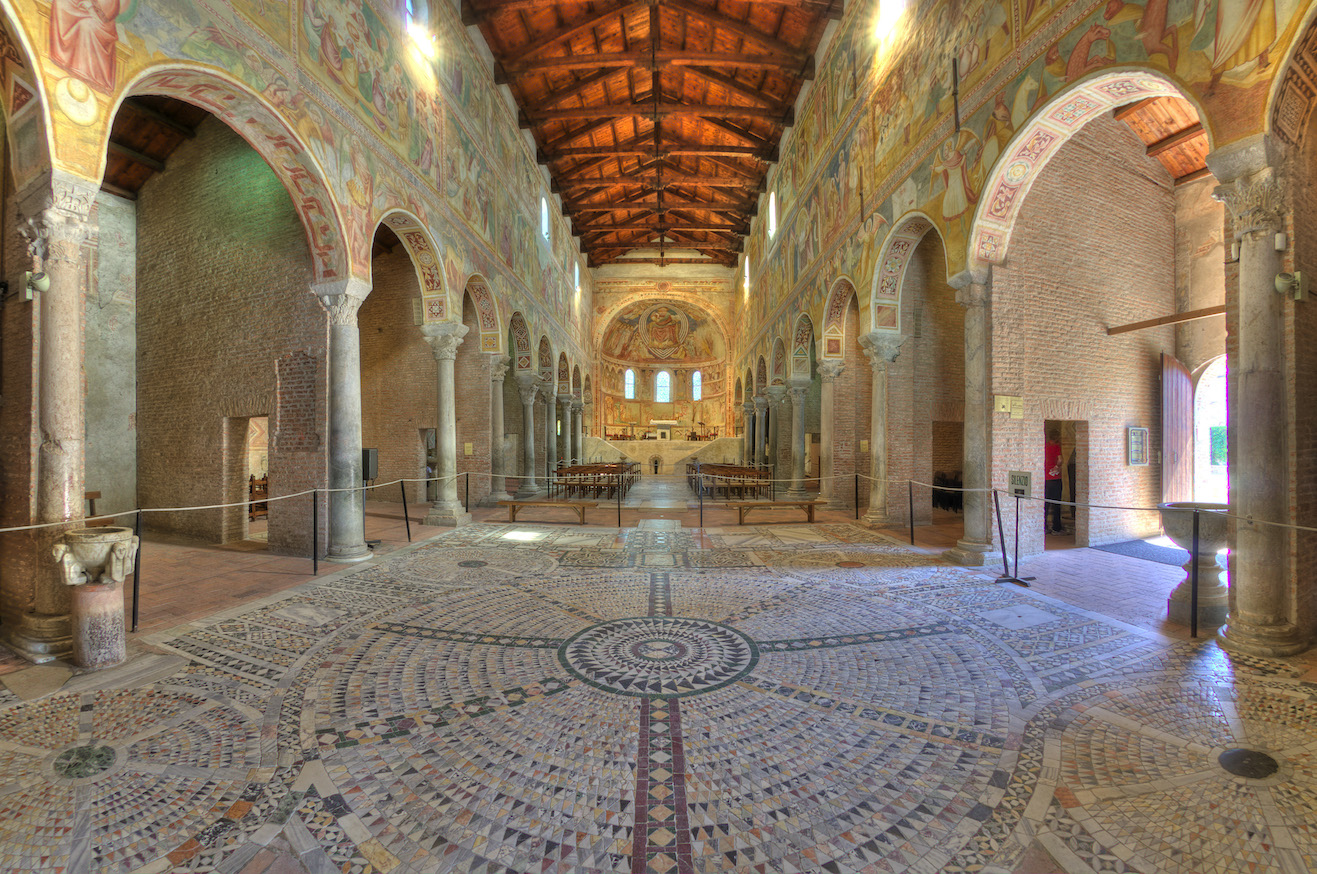
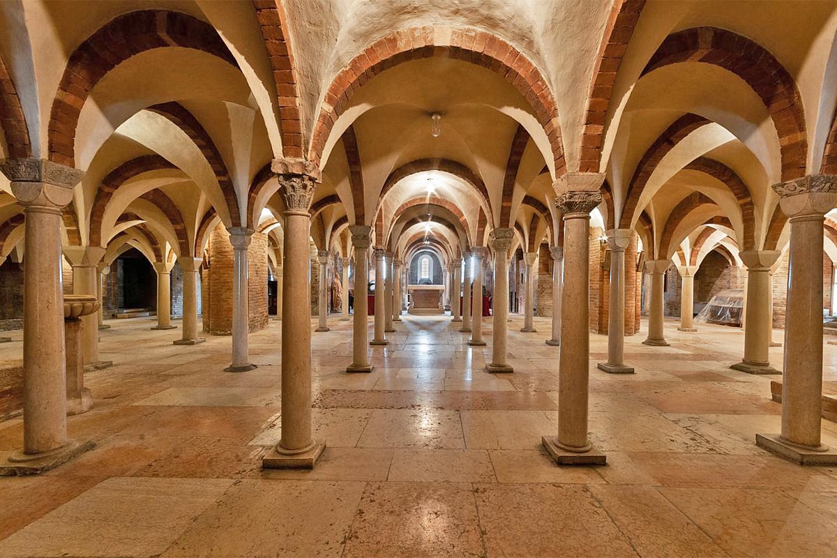
The Way of Saint Columbanus follows the footsteps of the Irish monk Columbanus, one of the most influential figures of his time, who crossed the Alps in 612 to reach Milan and then Bobbio, where he founded his last monastery in 614.
In this place, which became an important centre of culture and spirituality for the whole of northern Italy and beyond, the monk died the following year, in 615, and his remains are kept in the crypt of the abbey, which is why the monastery has been a place of pilgrimage for the faithful for centuries.
Route Planner
Author

Walter Manni
Explorer and Adventurer: loves sailing the oceans, climbing the highest mountains and surfing on the waves of the web
You may also like
by Walter Manni ///
Monasteries and Spiritual walks in Emilia-Romagna
by Davide Marino /// May 3, 2019
Emilia Romagna Slow | The Way of the Gods
by Walter Manni /// March 27, 2017

Interested in our newsletter?
Every first of the month, an email (in Italian) with selected contents and upcoming events.
Emilia Romagna Slow | The Francigena Way
by Walter Manni /// May 2, 2017
by Walter Manni ///
Monasteries and Spiritual walks in Emilia-Romagna
by Davide Marino /// May 3, 2019
Emilia Romagna Slow | The Way of the Gods
by Walter Manni /// March 27, 2017
Emilia Romagna Slow | The Francigena Way
by Walter Manni /// May 2, 2017
Mario Pampanin
Leggo, nella sintetica presentazione della Via Francigena, che “In the Emilia Romagna stretch, the Francigena Way crosses some historic villages of great historical and spiritual value such as Bobbio and Berceto.
The village of Bobbio, during the Middle Ages, was a place of extreme spiritual value; here, in fact, stood the Abbey of San Colombano, founded in 614 by the Irish monk Columbanus, which was one of the safe places that met along the road that led to Rome”.
L’indicazione relativa a Bobbio andrebbe però collocata nella presentazione della Via degli Abati (The Abbots Way).
Grazie per la cortese attenzione.
Walter Manni
Ciao Mario,
innazitutto grazie per averci scritto.
Avevamo inserito l’abitato di Bobbio come possibile borgo storico da visitale lungo il percorso, ma effettivamente potrebbe semrbare fuorviante.
Abbiamo quindi corretto il testo secondo delle indicaizoni geografiche più precise, cose che riporteremo anche nella versione italiana.
Grazie ancora dell’utile appunto
Walter, Staff In Emilia Romagna
Keith Wakefield
I’m fascinated by the philosophy and faith behind pilgrimage walks which in today’s sceptical world is a remarkable tribute to the faith tradition . I have walked to Assisi along one of the routes after being based in Gubbio , however , I would like reference to walks from Bologna so I can explore other pilgrimage routes ,. Can you help with the guides , maps and books I need for 2022 .