 Trails and pilgrimage routes
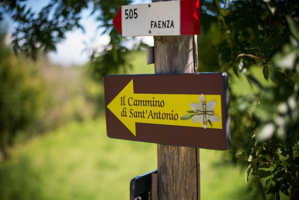
St Anthony’s Walk has been one of Europe’s main pilgrim paths for centuries, stretching from Veneto to Emilia-Romagna and Tuscany. It is a dual journey – both spiritual and physical – in the footsteps of St Anthony, one of the best-loved and most venerated saints in Christian history.
The original route, called The Last Walk, is quite short and carries great religious significance. It is about 15 miles long and coincides with the route from Camposampiero to Padua that Saint Anthony took on 13 June 1231 in an attempt to reach the Venetian city before drawing his last breath.
A second itinerary was opened in 2010, the Long Walk, across Emilia-Romagna. It extends the original one and touches on the places linked to the Saint’s wanderings during his life. Although the itinerary has a strong religious significance, it offers a unique opportunity to get in touch with oneself and the territories it crosses.
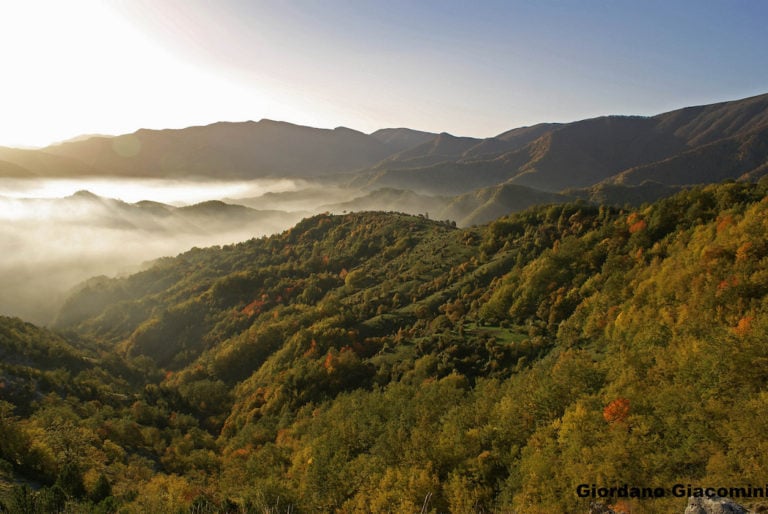
You can either start the trail in Camposampiero, Padua or Venice. It winds southwards for over 250 miles towards the sanctuary of La Verna in the heart of the Casentinesi Forests National Park, where St. Francis received the stigmata. This is also where the route joins the St. Francis Walk, connecting two of Italy’s favorite saints.
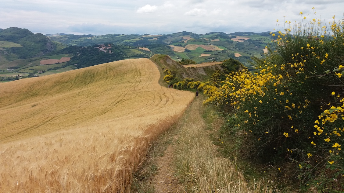
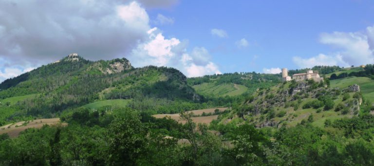
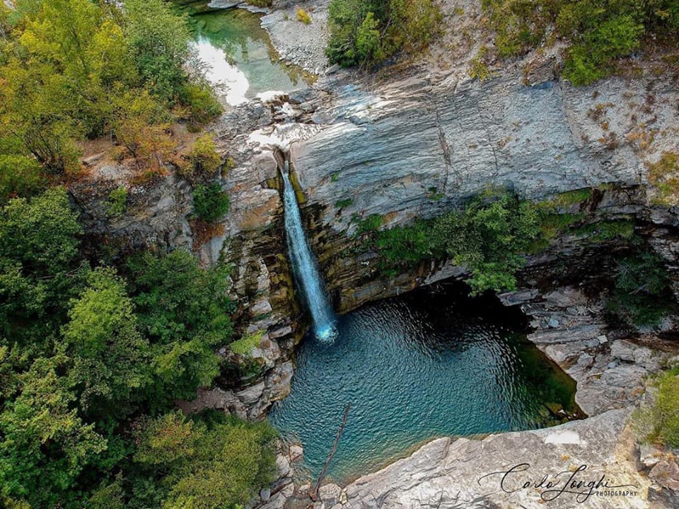
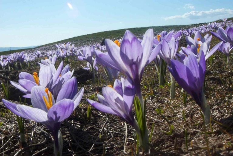
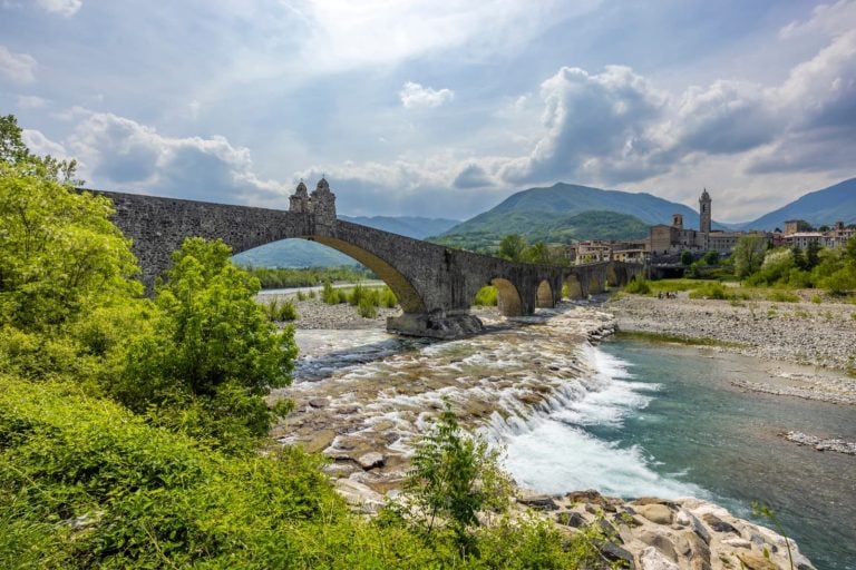
About 160 miles of the route run through Emilia-Romagna. There are many stunning sights along the way: the former rice field in Bentivoglio with its 228 bird species; the Gessi Bolognesi e Calanchi dell’Abbadessa Regional Park, a chalk upland with breathtaking views, ravines, ridges and natural amphitheatres hiding entrances to underground caves and tunnels; the Vena del Gesso Romagnola Natural Park with its gypsum deposits and beautiful walking paths; the Acquacheta waterfall, near San Benedetto in Alpe, at the gates of the Casentinesi Forests National Park with its beautiful unspoiled woodland.
Hamlets along the way
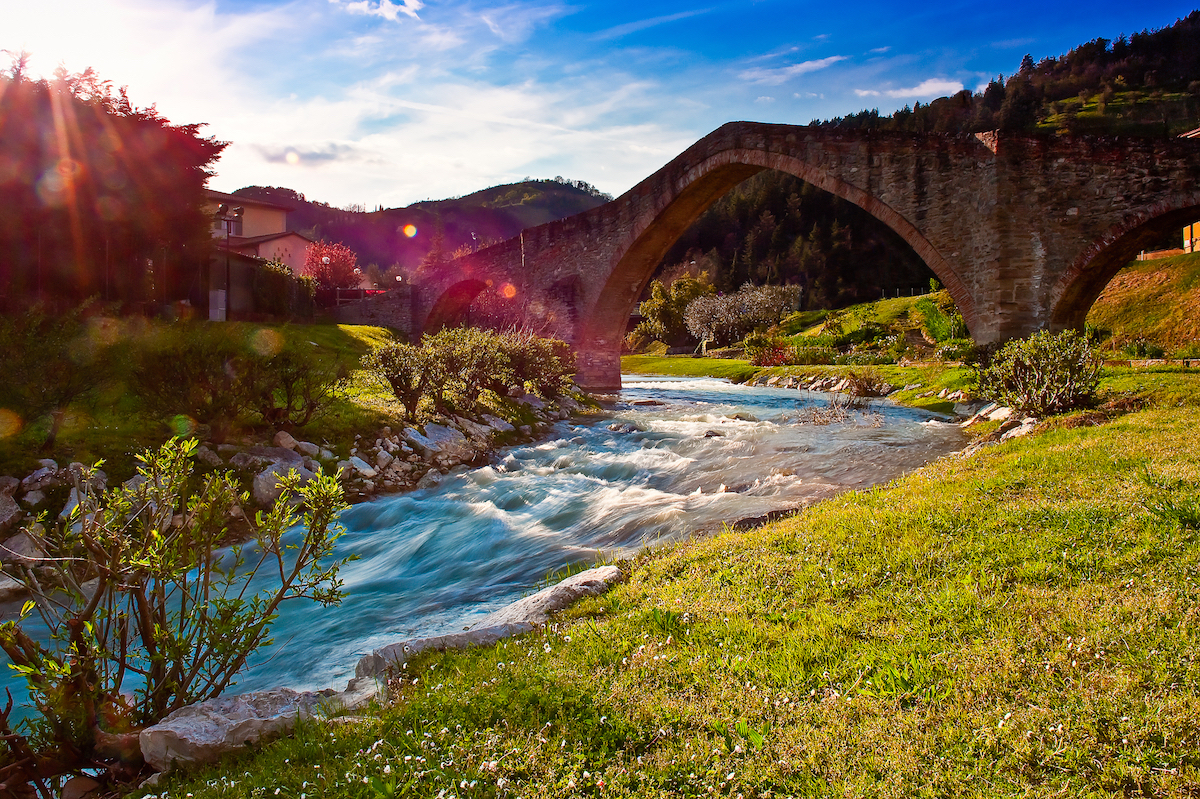
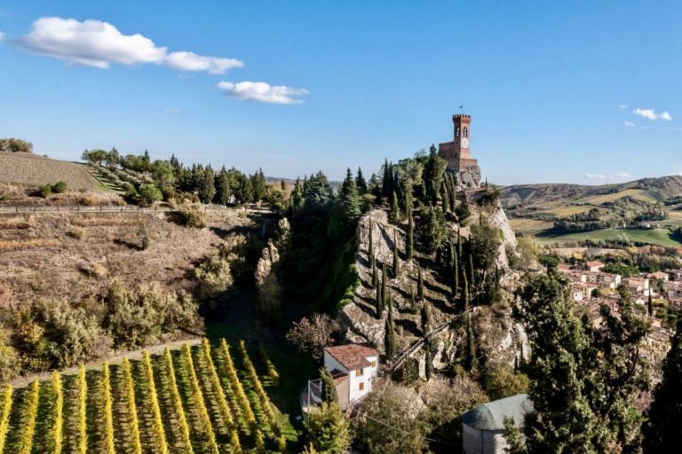
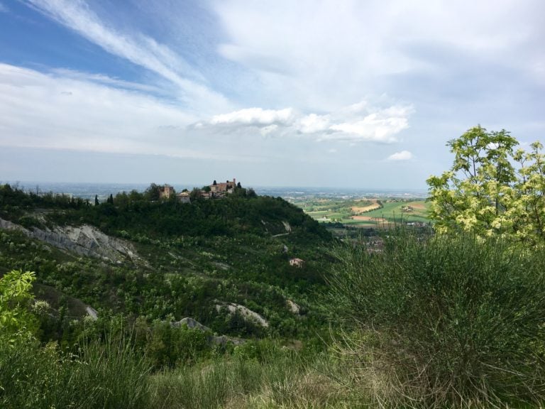
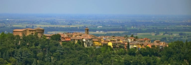
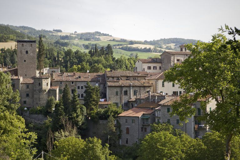
The route runs through some of Emilia Romagna’s loveliest towns and villages, especially in the Apennines. First up is Dozza, the town of the murals and the regional wine center. Then comes medieval Brisighella, one of the “Most Beautiful Villages in Italy” and an Italian Touring Club Orange Flag town, as are Portico di Romagna and San Benedetto in Alpe in the upper Montone valley. Modigliana, famous for its bridges. Then there’s tiny Dovadola with Montepaolo hermitage, where St. Anthony first lived and where his spiritual mission began. And finally, Rocca San Casciano, part of the Borghi Autentici d’Italia association.
Services and practical information
Bear in mind that this trail is mainly open from May to October, so try to avoid the winter, as Apennine paths are dangerous in harsh weather conditions. During the summer, prepare for the heat in exposed places, such as the Po river crossing and the Ferrara area.
The number of stages and the total distance vary depending on where you begin and which means of transport you use (by mountain bike or on foot). If you start at the sanctuary in Padua and head for La Verna, you’ll cover 255 miles in 21 stages.
Veneto
Stage 0 | (Last Walk) | Camposampiero – Padua (14.6 miles)
Stage 1 | Padua – Monselice (13.8 miles)
Stage 2 | Monselice – Rovigo (19.9 miles)
Stage 3 | Rovigo – Polesella (13.2 miles)
Emilia Romagna
Stage 4 | Polesella – Ferrara (14 miles)
Stage 5 | Ferrara – Malalbergo (11.9 miles)
Stage 6 | Malalbergo – Castel Maggiore (16 miles)
Stage 7 | Castel Maggiore – Bologna (13.2 miles)
Stage 8 | Bologna – Settefonti (11.9 miles)
Stage 9 | Settefonti – San Martino in Pedriolo (11.2 miles)
Stage 10 | San Martino in Pedriolo – Tossignano (10.4 miles)
Stage 11 | Tossignano – Parco Naturale del Carné (14.3 miles)
Stage 12 | Parco Naturale del Carné – Modigliana (10.6 miles)
Stage 13 | Modigliana – Montepaolo (10 miles)
Stage 14 | Montepaolo – Rocca San Casciano (14.1 miles)
Stage 15 | Rocca San Casciano – Portico di Romagna (7.3 miles)
Stage 16 | Portico di Romagna – San Benedetto in Alpe (10.1 miles)
Stage 17 | San Benedetto in Alpe – Castagno D’Andrea (13.4 miles)
Stage 18 | Castagno D’Andrea – Poggio Lastraiolo (7.9 miles)
Stage 19 | Poggio Lastraiolo – Camaldoli (8.3 miles)
Tuscany
Stage 20 | Camaldoli – Badia Prataglia (10 miles)
Stage 21 | Badia Prataglia – Santuario della Verna (13 miles)
Most paths are well marked, but not all of them, so do download the map from the official website or bring a detailed map with you. A network of mountain refuges is maintained by the association that manages the route (details here). Of course, there are many towns and villages with hotels and restaurants along the way, so you should have plenty of choice of bed and board.
If you want to make your journey “official”, don’t forget to ask for a Pilgrim’s Credential before you leave Padua; then, once you reach La Verna, ask the friars to stamp it, and you will receive a well-deserved Assidua or certificate of completion. You’ll then be a proper pilgrim with full effect.
The “Emilia Romagna Slow” column is produced as part of the Experiential Tourism Walk project with the Network of Operators and Paths participating in the circuit.
For any kind of information about it go to camminiemiliaromagna.it or write to m.valeri@aptservizi.com
Author

Davide Marino
Davide Marino was born archaeologist but ended up doing other things. Rational – but not methodic, slow – but passionate. A young enthusiast with grey hair
You may also like
Saint Francis’s walk from Rimini to La Verna
by Arturo Castellini /// October 20, 2017
Discover Brisighella: a route between Nature and Archaeology
by Davide Marino /// December 1, 2016
1. The most beautiful waterfalls in Emilia-Romagna
by Elisa Mazzini /// March 29, 2018

Interested in our newsletter?
Every first of the month, an email (in Italian) with selected contents and upcoming events.
The Casentinesi forests, Monte Falterona and Campigna National Park
by Walter Manni /// March 26, 2018
Natural parks in and around Bologna
by Elisa Mazzini /// April 16, 2018
The “Orange Flag” Villages in Emilia-Romagna
by Elisa Mazzini /// December 10, 2024
Saint Francis’s walk from Rimini to La Verna
by Arturo Castellini /// October 20, 2017
Discover Brisighella: a route between Nature and Archaeology
by Davide Marino /// December 1, 2016
1. The most beautiful waterfalls in Emilia-Romagna
by Elisa Mazzini /// March 29, 2018
The Casentinesi forests, Monte Falterona and Campigna National Park
by Walter Manni /// March 26, 2018
Natural parks in and around Bologna
by Elisa Mazzini /// April 16, 2018
The “Orange Flag” Villages in Emilia-Romagna
by Elisa Mazzini /// December 10, 2024