 Trails and pilgrimage routes
Romea Strata Way is the name given to a series of old pathways that from central and eastern Europe lead to the north-eastern border of the Italian peninsula and all the way to the city of Rome.
The routes coming down from Poland, the Czech Republic and Austria crossed the Alpine border near Tarvisio; the routes coming from the Balkans, Hungary and Slovenia passed through the town of Gorizia, while those coming from Croatia passed through the town of Trieste. All of them were part of the ancient Romea Strata routes, although locally they were given different names depending on the territories they crossed along the way.
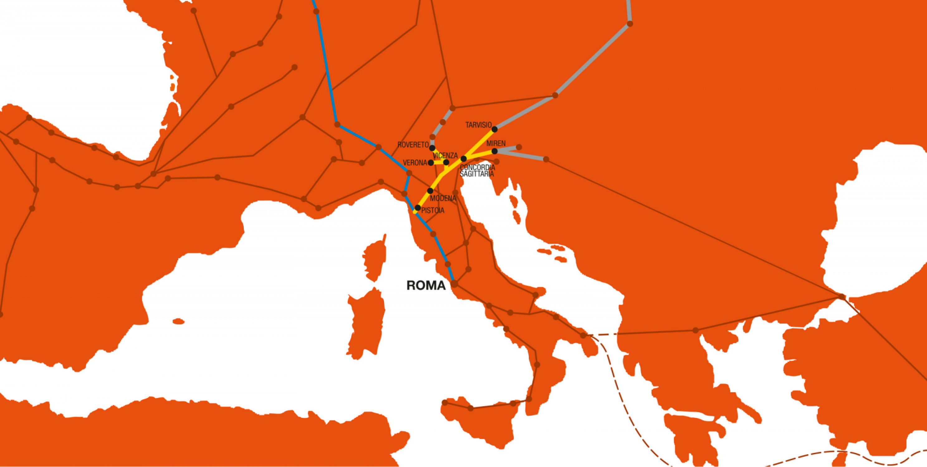
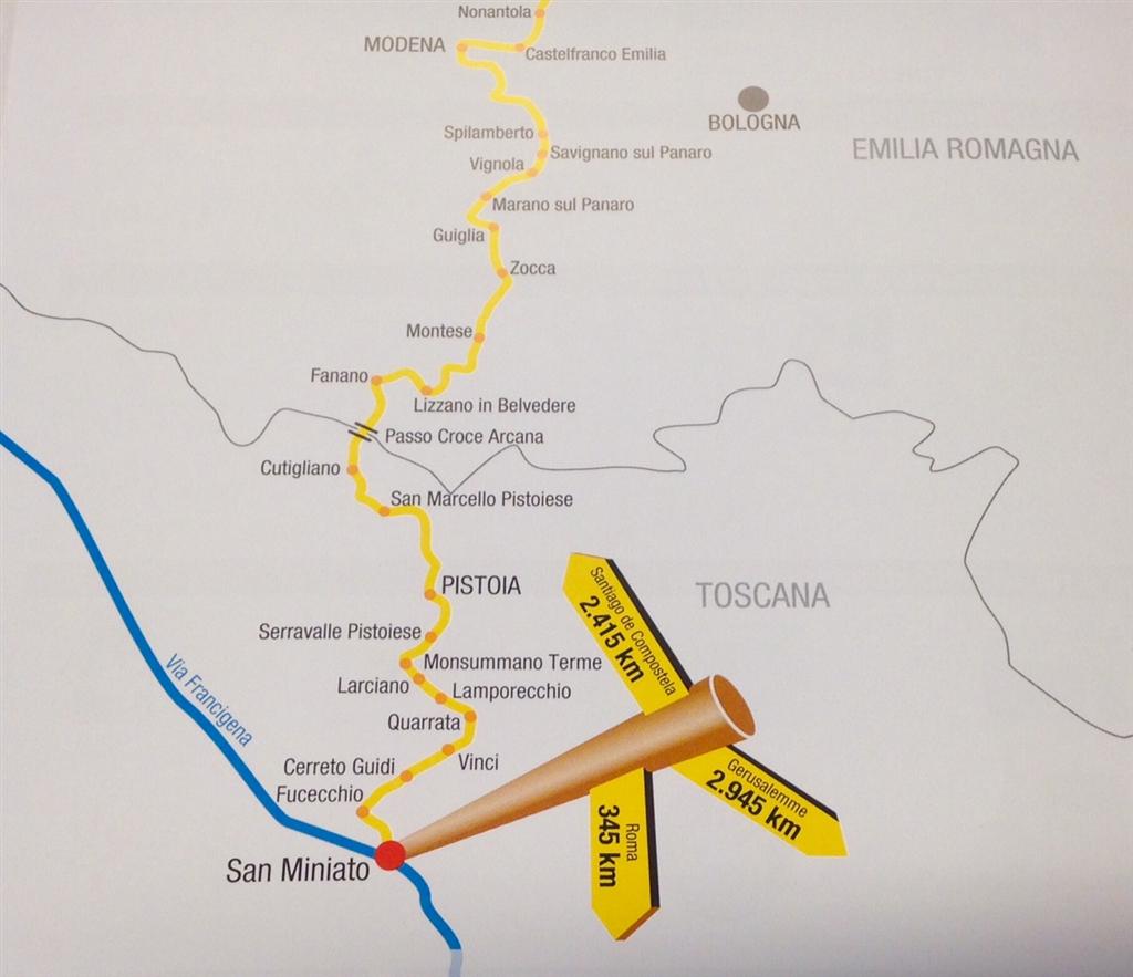
The Romea Strata was therefore usually divided into seven different small routes (Allemagna, Aquileiense, Annia, Nonantolana-Longobarda, Postumia, Porciliana and Vicetia). Its importance was dictated by the fact that it allowed, once it rejoined the Via Francigena at Fucecchio, to choose whether to continue the journey towards Rome and the southern ports where to embark for Jerusalem, or towards the sanctuary of Santiago de Compostela.
During the period of great pilgrimages, the Via Romea Strata was one of the main European routes leading to the most important holy places of Christianity.
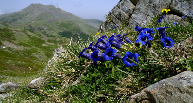
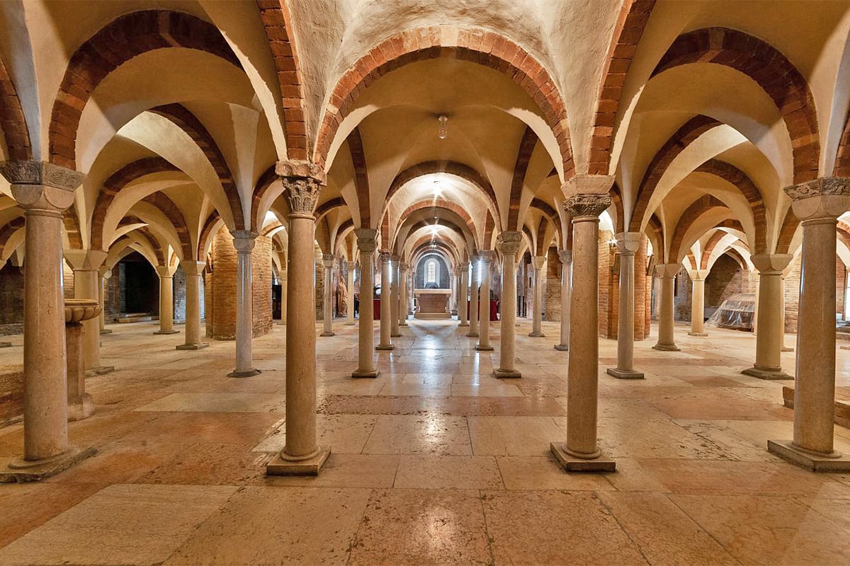
Whichever European country the pilgrims left from and whichever of the seven different routes of the Romea Strata they chose to follow, all of them, once they had crossed the river Po, converged in Emilia Romagna at Badia Polesine. From there, the path passed through the village of Bondeno and then across the Po Valley to Nonantola Abbey, where it began the climb to the Vignola and Spilamberto castles, the Rocca Malatina and the Frignano Natural Parks, before reaching the Apennine peak at the Croce Arcana pass. From here, the path descended to Pistoia, Fucecchio, and San Miniato, where it rejoined the Via Francigena.
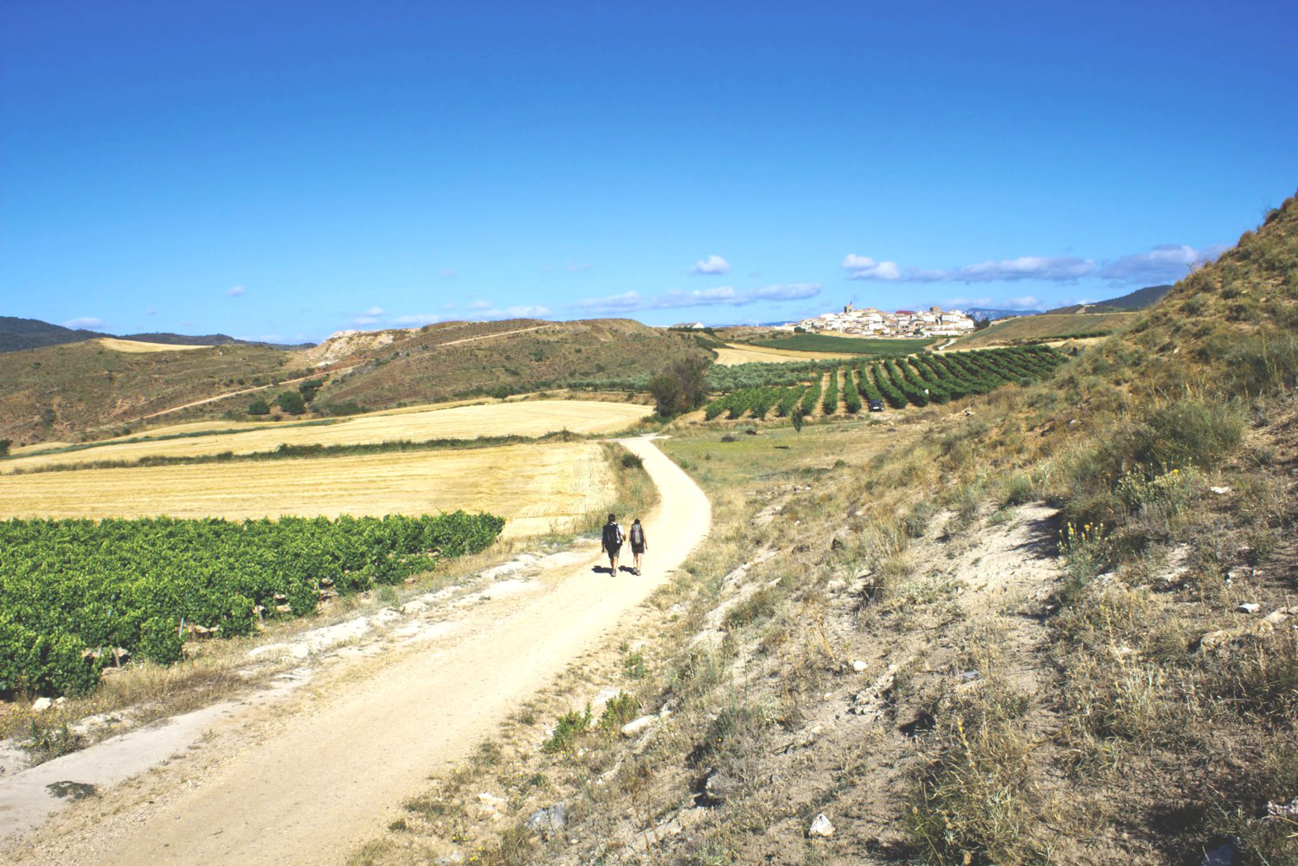
The Romea Strata Way is now a great route that connects cultures, histories, and religions from eastern Europe to central Italy, through places of great historical and spiritual importance. It is both a trip through the historic heart of Italy and a journey of discovery among some of the most significant Christian sites in the whole country.
Hamlets along the Way
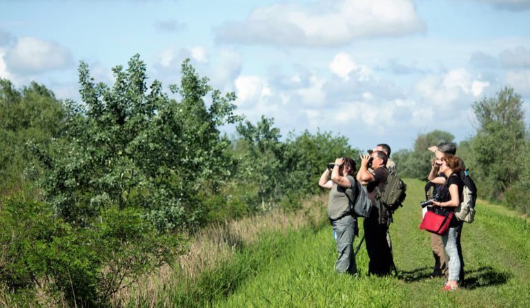
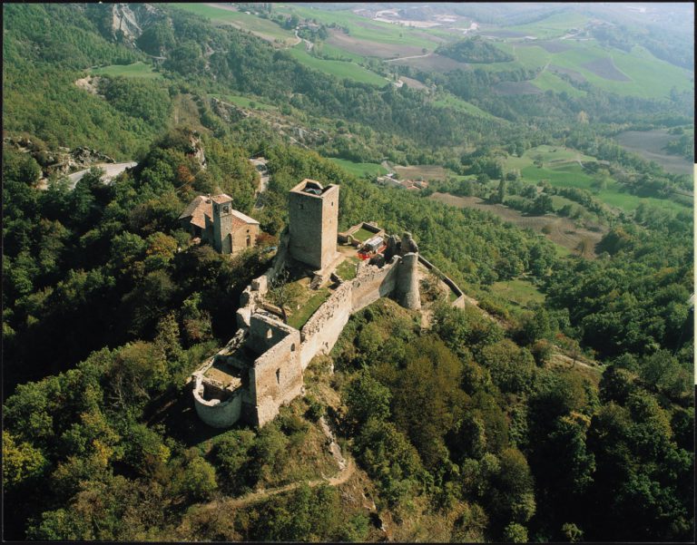
Along with the Romea Nonantolana Way, the Romea Strata Way is one of the most evocative spiritual ways in the Modena area, running through some of the loveliest little towns in the area. Like Vignola, for example, with its imposing castle; Spilamberto, the balsamic vinegar town; and Fanano, a village in the High Modena Apennines Regional Park renowned for outdoor activities from walking and mountain biking in the summer months to skiing and snowshoeing in winter.
Fanano is also a good base for tackling Mount Cimone, the highest peak in the northern Apennines (2,165 mt).
Services and practical information
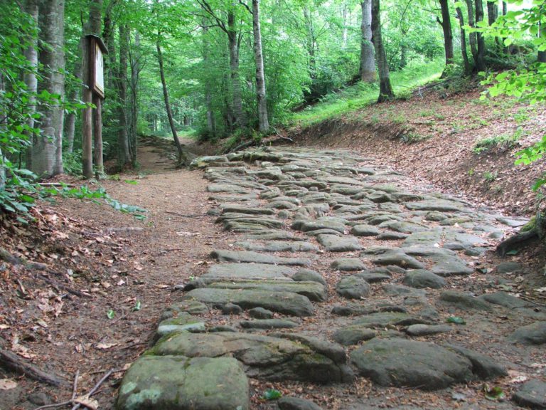
The Romea Strata Way runs through 185 miles of Italian countryside (115 of which in Emilia-Romagna). It crosses a land that is still shaped by monastic orders, aristocratic families and medieval villages, where every stone has a story to tell about the pilgrims, merchants, and ambassadors who have passed by over the years.
The Way’s official website tells you about its various branches, with specific technical details, including downloadable GPS maps of all the stages. It also describes how to get your official Pilgrim’s Credential and certificate of completion.
Italian regions traversed: Emilia-Romagna, Tuscany
Stages: The Way has the following stages, based around convenient places to stop for the night:
Stage 1 | Stellata – Finale Emilia (13.3 miles)
Stage 2 | Finale Emilia – Nonantola (23 miles)
Stage 3 | Nonantola – Spilamberto (21.8 miles)
Stage 4 | Spilamberto – Gainazzo (17.8 miles)
Stage 5 | Spilamberto – Savignano sul Panaro – Marano sul Panaro (alternative) (6.5 miles)
Stage 6 | Savignano sul Panaro – Vignola – Marano sul Panaro (alternative) (4.3 miles)
Stage 7 | Gainazzo – Montese (11.8 miles)
Stage 8 | Montese – Fanano (14.6 miles)
Stage 9 | Fanano – Capanno Tassoni (2.5 miles)
Length: over 185 miles (115 in Emilia-Romagna)
Difficulty: medium
Information
Tourist Information Office
Via Roma 21 Palazzo della Partecipanza, Nonantola (MO)
059.896555 / uit@comune.nonantola.mo.it
For any info about [Slow Emilia Romagna] plese contact <m.valeri@aptservizi.com>
Author

Walter Manni
Explorer and Adventurer: loves sailing the oceans, climbing the highest mountains and surfing on the waves of the web
You may also like
by Walter Manni ///
Emilia Romagna Slow | The Romea Nonantolana Way
by Walter Manni /// July 24, 2017

Interested in our newsletter?
Every first of the month, an email (in Italian) with selected contents and upcoming events.
Emilia Romagna Slow | The Way of the Gods
by Walter Manni /// March 27, 2017
by Walter Manni ///
Emilia Romagna Slow | The Romea Nonantolana Way
by Walter Manni /// July 24, 2017
Emilia Romagna Slow | The Way of the Gods
by Walter Manni /// March 27, 2017