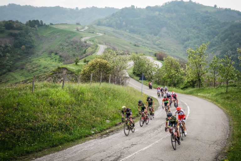
 Cycling Tourism
Bike lovers, this is your time to shine!
Don’t miss the chance to practise your favourite sport surrounded by pristine nature in a gently undulating landscape of hills and valleys full of historical and architectural gems.
We already talked about the Regional parks (suitable for the whole family) in the past, as well as the 4 best cycling routes in Romagna between nature and culture. Today, we’d like to introduce you to the 10 Cycle Paths of the Parks of our region, 10 cycling routes from the province of Piacenza to Romagna running through 9 regional parks and a nature reserve.
These cycling paths are suitable for everyone, even beginners, since the paths have different levels of difficulty and can be cycled in 1-day or half-day stages.
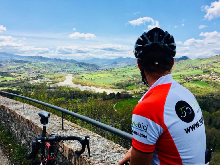
To choose the path that best suits your skills, just have a look at the technical sheets below including information on length, gradient, level of difficulty, travel times, points of interest and useful contact details. We also recommend checking the GPS map and then simply follow the signs once you are on site.
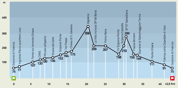
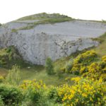
Ciclovia dello Stirone
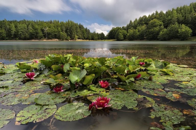
Route description: Ciclovia dello Stirone
Location: Stirone and Piacenziano Regional Park
Route length: 26 miles
Ascent: max. 0,2 miles
Difficulty: moderate difficulty up to Trabucchi, medium for complete route
Travel time: one day
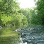
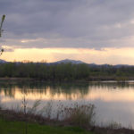
Ciclovia del Taro
Route description: Ciclovia del Taro
Location: Taro River Regional Park
Route length: 12 miles for the first route, 3,7 for the second
Ascent: negligible
Difficulty: low for the first route, medium for the second
Travel time: half day
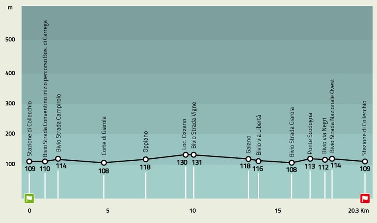
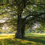
Ciclovia Boschi di Carrega
Route description: Ciclovia Boschi di Carrega
Location: Carrega Woods Regional Park
Route length: 12,5 miles approximately
Ascent: 0,12 miles
Difficulty: low
Travel time: half day
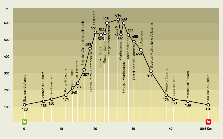
Ciclovia del Parco dei Sassi
Route description: Ciclovia del Parco dei Sassi
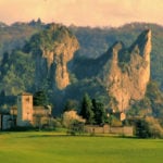
Location: Sassi di Roccamalatina Regional Park
Route length: 31 miles approximately
Ascent: 0,34 miles
Difficulty: high
Travel time: one day
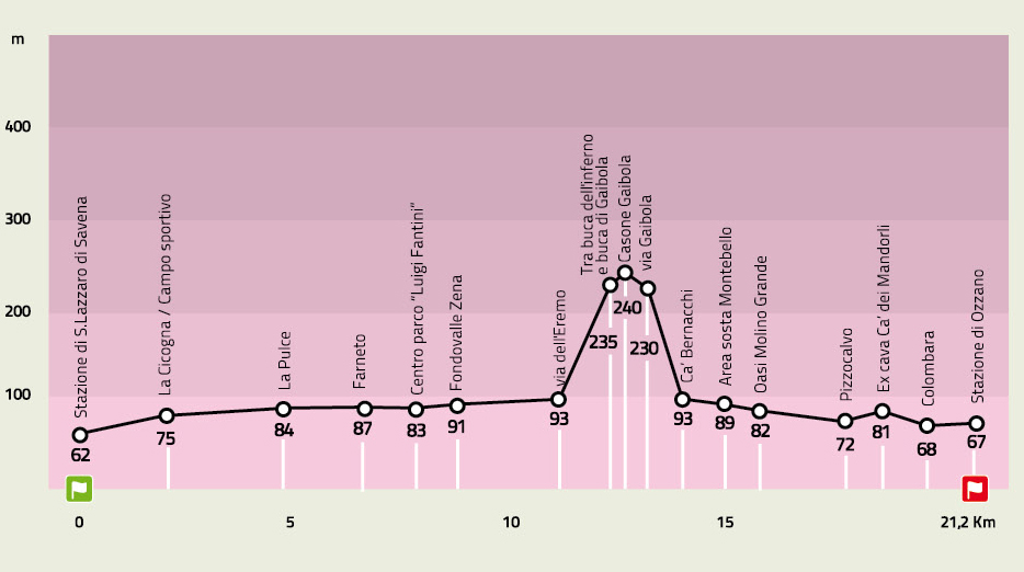
Ciclovia dei Gessi di Gaibola
Route description: Ciclovia dei Gessi di Gaibola
Location: Gessi Bolognesi e Calanchi dell’Abbadessa Regional Park
Route length: 13 miles
Ascent: 0,12 miles
Difficulty: medium
Travel time: half day
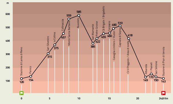
Ciclovia della Memoria
Route description: Ciclovia della Memoria
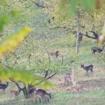
Location: Monte Sole Historical Regional Park
Route length: 15,5 miles approximately
Ascent: 0,34 miles
Difficulty: medium to high
Travel time: one day
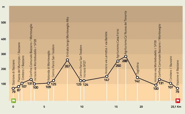
Ciclovia di Monteveglio
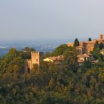
Route description: Ciclovia di Monteveglio
Location: Monteveglio Abbey Regional Park
Route length: 16,7 miles
Ascent: 0,23 miles
Difficulty: low
Travel time: half day
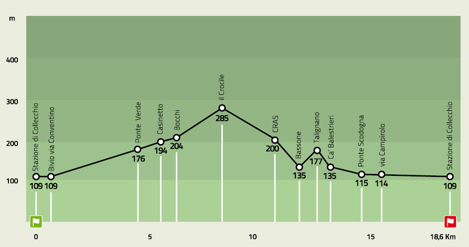
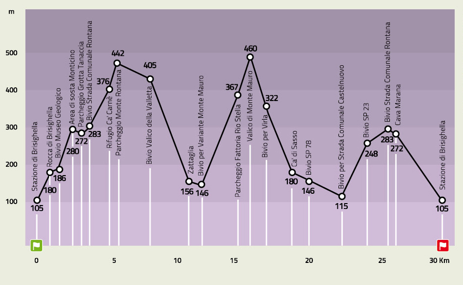
Ciclovia dei Gessi
Route description: Ciclovia dei Gessi
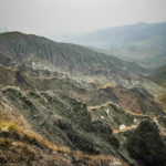
Location: Vena del Gesso Romagnola Regional Park
Route length: 18,6 miles approximately
Ascent: 0,55 miles
Difficulty: high
Travel time: one day
Suggested experience: Hiking and cycling on the hills between Faenza and Brisighella
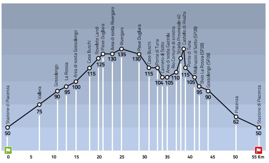
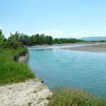
Ciclovia del Trebbia
Route description: Ciclovia del Trebbia
Location: Trebbia River Regional Park
Route length: 31 miles approximately
Ascent: 0,05 miles
Difficulty: low to medium
Travel time: one day
Ciclovia del Secchia
Route description: Ciclovia del Secchia
Location: Secchia River Detention Basin Nature Reserve
Route length: 15,5 to 23,6 miles depending on detours
Ascent: negligible
Difficulty: low
Travel time: one day

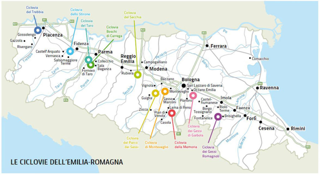
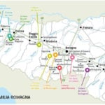
Mappa delle Ciclovie dei Parchi in Emilia Romagna
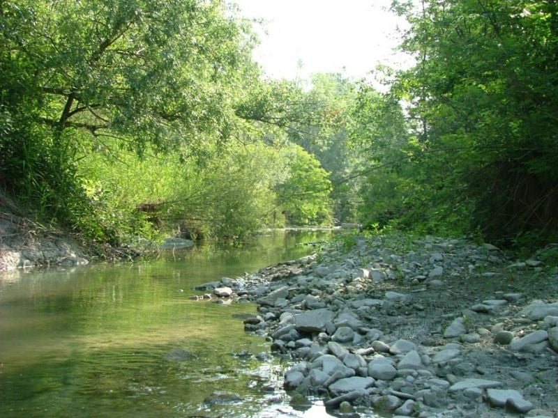
Parco dello Stirone | Ph. parchidelducato
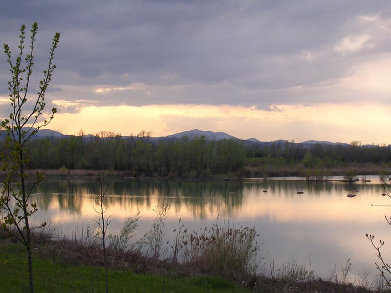
Tramonto sul Taro | Ph. parchidelducato
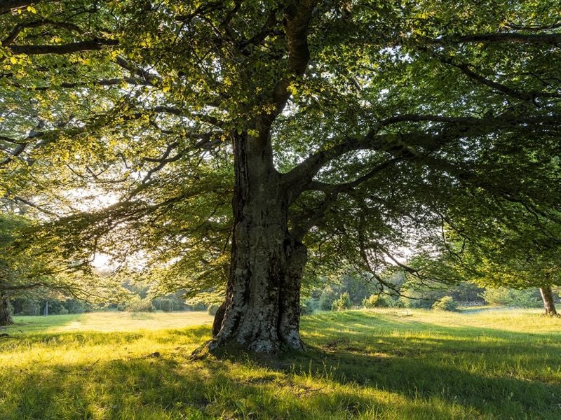
Faggio nei Boschi di Carrega | Ph. Sara Soliani, parchidelducato
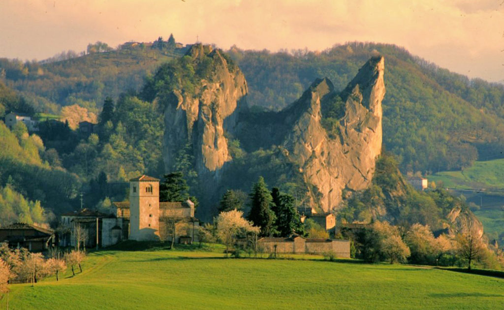
Sassi di Roccamalatina | Ph. italyformovies
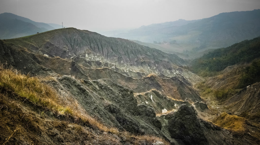
Parco Regionale Gessi Bolognesi | Ph. paPisc
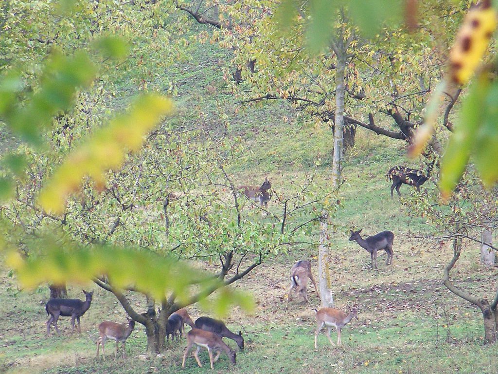
Daini a Monte Sole | Ph. @lpvva1 via Flickr
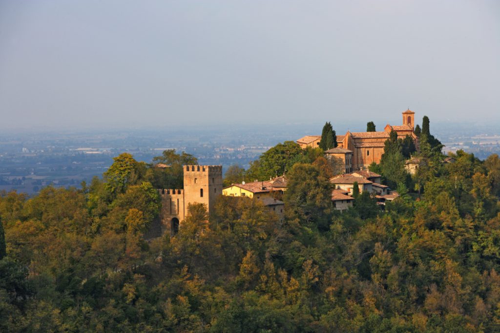
Castello e Abbazia di Monteveglio
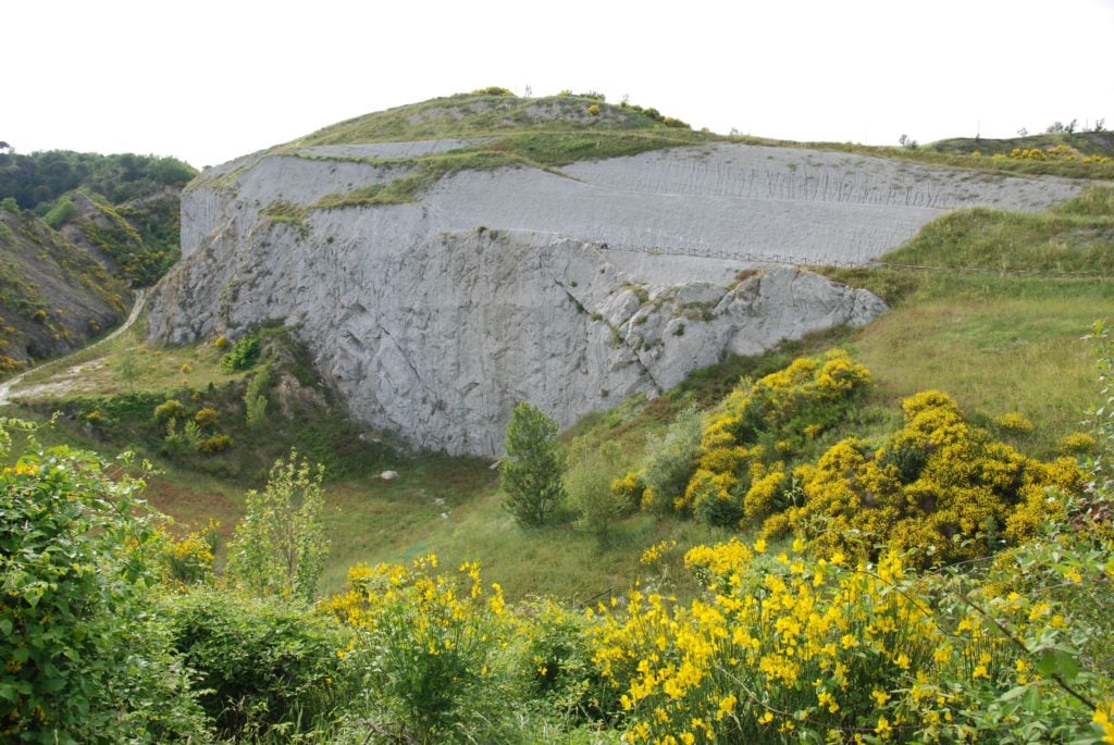
Parco della vena del gesso romagnola | Ph. brisighellaospitale
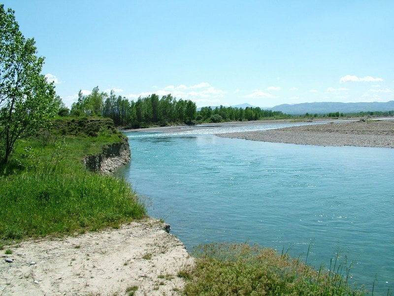
Greto del Trebbia | Ph. R.Ziliani, parchidelducato
If you want to make your trip even more sustainable, remember that you can also reach these routes by train. Just look for the specific signs at the nearest train station that will show you how to easily reach the protected area and the cycling path.
The following resources are also available free of charge at the visitor centres of the areas:
– The “Ciclovie dei Parchi” leaflet;
– The “Ciclovie dei Parchi” roadmap.
Author
You may also like
Eventi ciclistici 2024 in Emilia-Romagna
by Elisa Mazzini /// February 7, 2024
Cycling #inEmiliaRomagna: 4 routes among nature & culture
by Lo Staff /// May 22, 2018

Interested in our newsletter?
Every first of the month, an email (in Italian) with selected contents and upcoming events.
Cycling Emilia Romagna: pure joy for bike lovers
by Walter Manni /// November 19, 2018
Parks and thermal spas: a weekend of wellbeing
by Celestina Paglia /// September 21, 2020
Eventi ciclistici 2024 in Emilia-Romagna
by Elisa Mazzini /// February 7, 2024
Cycling #inEmiliaRomagna: 4 routes among nature & culture
by Lo Staff /// May 22, 2018
Cycling Emilia Romagna: pure joy for bike lovers
by Walter Manni /// November 19, 2018
Parks and thermal spas: a weekend of wellbeing
by Celestina Paglia /// September 21, 2020
Kjesten
Would you please supply me with information about renting bicycles for these trips. I will be travelling from overseas so will not be able to bring my own bike. I do a lot of mountain and track cycling so am not interested in a commuter style bike.
Thank you
Davide Marino
Your question is hard to answer. Which cycle path do you will intend to ride? Emilia-Romagna is big
Davide – staff #inEmiliaRomagna