 Nature & Outdoor
Walking amid nature until the limit of human civilization, where the forest finds its original state, in the kingdom of wild animals.
Hiking in nature is one of those activities that still allow us to access to a “different” dimension of natural space: as we walk along an ancient path the traces of human civilization – such as countries, villages and farms – slowly leave their space for the large expanses of woodland.
Hiking along natural paths means a rediscovery of this landscape, along with the traces of the men who have inhabited it for centuries.
So we would like to suggest you 5 hiking trails of the Emilia Romagna with a historical and natural value in which to find a different relationship with nature and history.
5 trails symbolizing the wide hiking network of Emilia-Romagna Region: 7000 km of marked hiking trails, which extends from the Apennine ridge to the plains and which are now also available on the app Maps4You for Android and IOS.
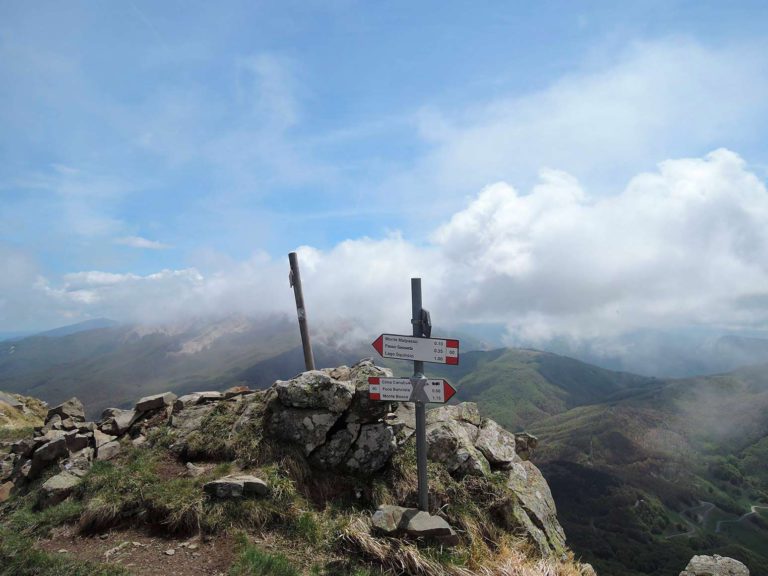
"Alta Via" - the Great trails of the Parks
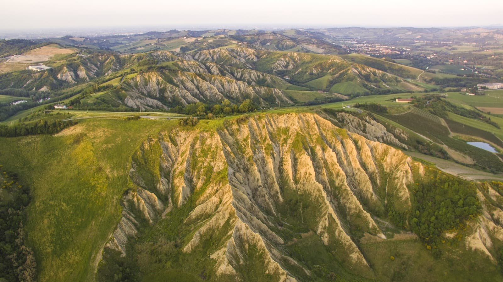
Calanchi di Torranello, Parco Vena del Gesso Romagnola | Ph. Giosbriff WLE2019
Certainly the largest hiking route in Emilia Romagna, the “Alta Via“ is a fantastic itinerary to explore the Apennines between Emilia-Romagna, Tuscany and Marche.
Almost 500 kilometers of ascents and descents that summarize in itself the best that the Apennine mountains can offer with glacial cirques, lakes immersed in the splendor of high altitude meadows, endless forests, clear streams, volcanic cliffs and chalk cliffs on that ridge between Europe and the Mediterranean.
The Alta Via owes its name to the fact that it crosses a total of eight natural parks: two national parks (Parco dell’Appennino Tosco Emiliano – Parco delle Foreste Casentinesi e dei monti Falterona e CampignaParco dell’Alto Appennino Modenese, Valli del Cedra e Parma, Corno alle Scale, Laghi di Suviana e Brasimone, Vena del GessoSasso Simone Simoncello).
The path of the “Alta Via” is usually divided into 27 stages, so it can be tackled in some individual stages and is clearly identifiable by hikers thanks to special coordinated signage.
You can also find the downloadable GPS tracks of the 27 stages that make up the itinerary; files can also be downloaded individually, in GPX format.
It is also available the Maps4You App (available for both Android and Apple), a free application which presents a list of specific thematic maps, in addition to all the other trails of the Emilia-Romagna Region.
Technical specifications
Lenght: about 500 Km
Difficulty: E+
Recommended Season: from May to September, depending on snow conditions.
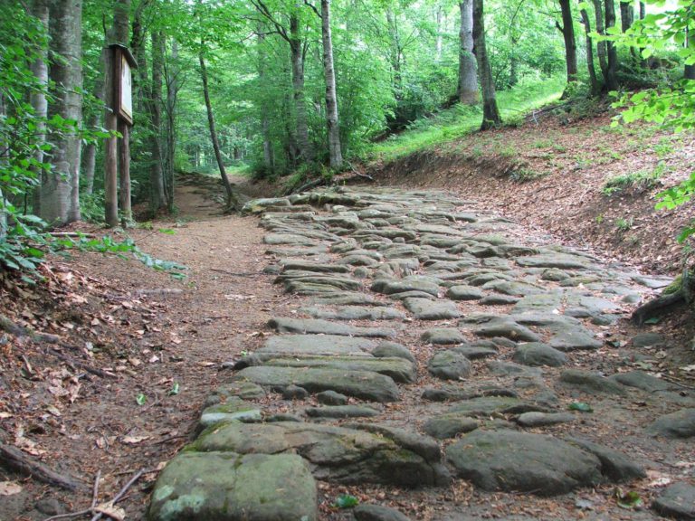
Via Vandelli: from Emilia Romagna to the Sea
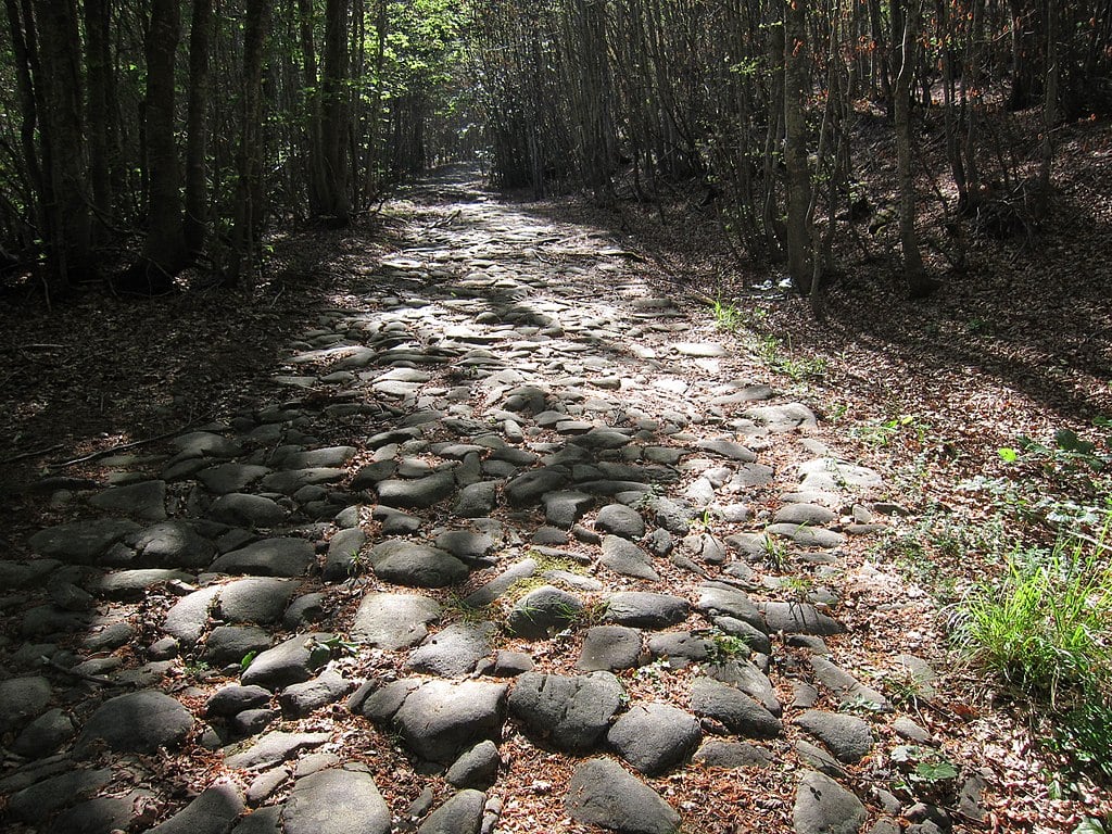
Via Vandelli – Selva Romanesca, Modena Ph. Giuliof via Wikipedia
The Vandelli Route was born at the behest of the Duke of Modena, Francesco III d’Este, who wished to have safe access to the Tyrrhenian sea on the territory of the duchy. The mathematician Domenico Vandelli was thus instructed to draw the impervious route of a carriageway to cross the Apennines and, after ten years of work, in 1751 the road was completed. Unfortunately, the itinerary was too arduous to allows the carriages to pass, was infested by bandits and the snow covers the road for many months a year, which soon made it an abandoned itinerary.
The Via Vandelli is today a spectacular hiking route which connects the cities of Modena and Massa Carrara along the Modenese Apennines and the Apuan Alps. With a week of walking, starting from Modena, you can reach the mountains of Frignano until you enter the valleys of Garfagnana in Tuscany.
Unfortunately today there are no detailed hiking maps of the Via Vandelli, so we recommend all those wishing to travel this spectacular itinerary to contact in advance the local section of Club Alpino Italiano in Modena or Massa, in order to have an update of the conditions of the trails.
Technical specifications
Length: about 200 Km
Difficulty: E +
Recommended Season: From May to September, depending on snow conditions.
The Path of Sacred Forests
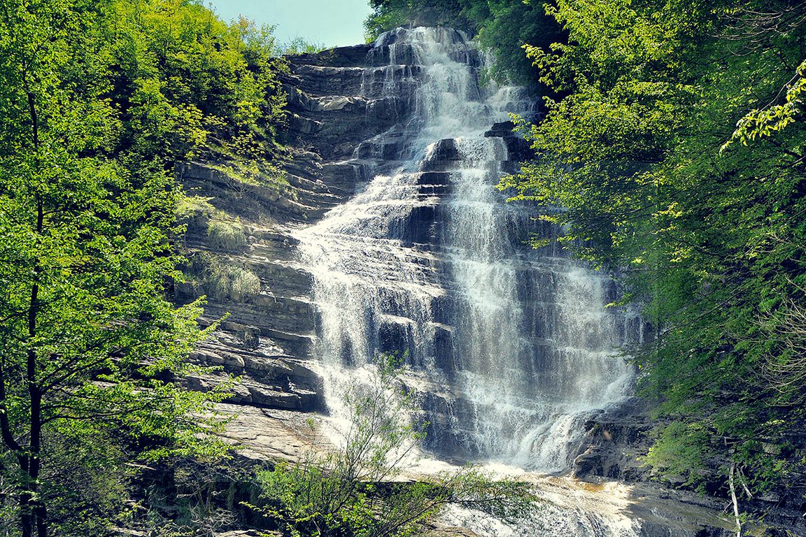
The Waterfalls of Acquacheta | Ph. Parco Foreste Casentinesi
A combination of nature and spirituality that crosses the Casentinesi Forests Natural Park, touching all the most significant points. These uncontaminated forests have hosted for over a thousand years communities of monks who have lived in very close relationship with the surrounding environment, nature from which they derived precious timber and where they found the conditions necessary for contemplation, inner recollection, and prayer.
The Path of Sacred Forests is a path of about 100 kilometers which is divided into seven stages, from Lake di Ponte di Tredozio to La Verna, seven days in which cars and towns are rarely encountered and with the opportunity to visit the most evocative places: the Acquacheta Valley, Mount Falterona, the Campigna Forest, the Santa Valley, Camaldoli and La Verna.
The Foreste Casentinesi Natural Park has been declared a UNESCO World Heritage Site thanks to the presence of beech woods among the oldest in Europe, with a widespread heritage on the national territory of ancient trees that exceed 400-500 years of age and located in the southernmost section of the continent.
Technical specifications
Length: about 95 Km
Difficulty: E
Recommended Period: from May to November.
The Gothic Line: in the footsteps of History
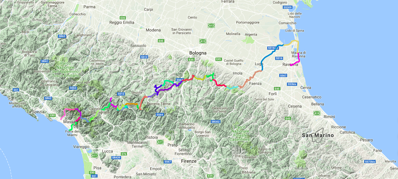
Gothic Line – Map
The Gothic Line was the defensive line organized by the German army along the Tuscan-Emilian Apennines, from the Tyrrhenian coast to the Adriatic, and was built to curb the advance of the Allies at the end of the Second World War.
The original route climbs in the village of Sarzana, straddling the present-day provinces of La Spezia and Massa Carrara, and continued along the Apuan Alps and the Garfagnana, following the ridges of the Emilian and Tuscan Apennines to arrive in Montefeltro area and Pesaro.
The hike of the Gothic Line today follows the cartography developed by the German army in 1944 and it’s the result of a research work in the military archives of Friborg by the historian Carlo Gentile and the Emilia-Romagna Institute of Cultural Heritage.
It’s a historical-naturalistic itinerary of several days that starts from Massa-Carrara and ends in Ravenna and is usually divided into 25 stages that cross six different natural environments such as the Apuan Alps, the Italian Apennines and the Romagna Plain.
A spectacular itinerary between mountains ridges, but also a journey into collective memory: a silent thanks to those, our countrymen or who came from distant countries, between those woods and those cliffs have sacrificed their young years for the freedom of Italy.
Technical specifications
Length: about 376 Km
Difficulty: E
Recommended Season: from May to November.
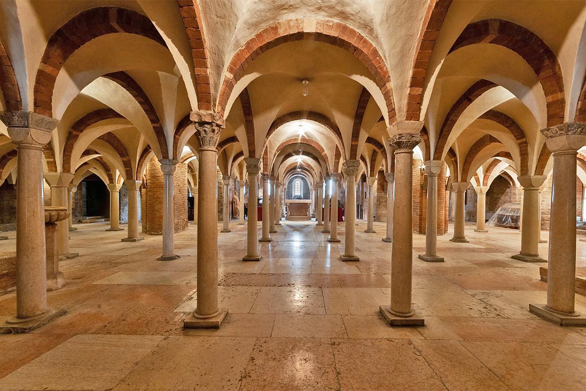
The Royal Fir Wood ring
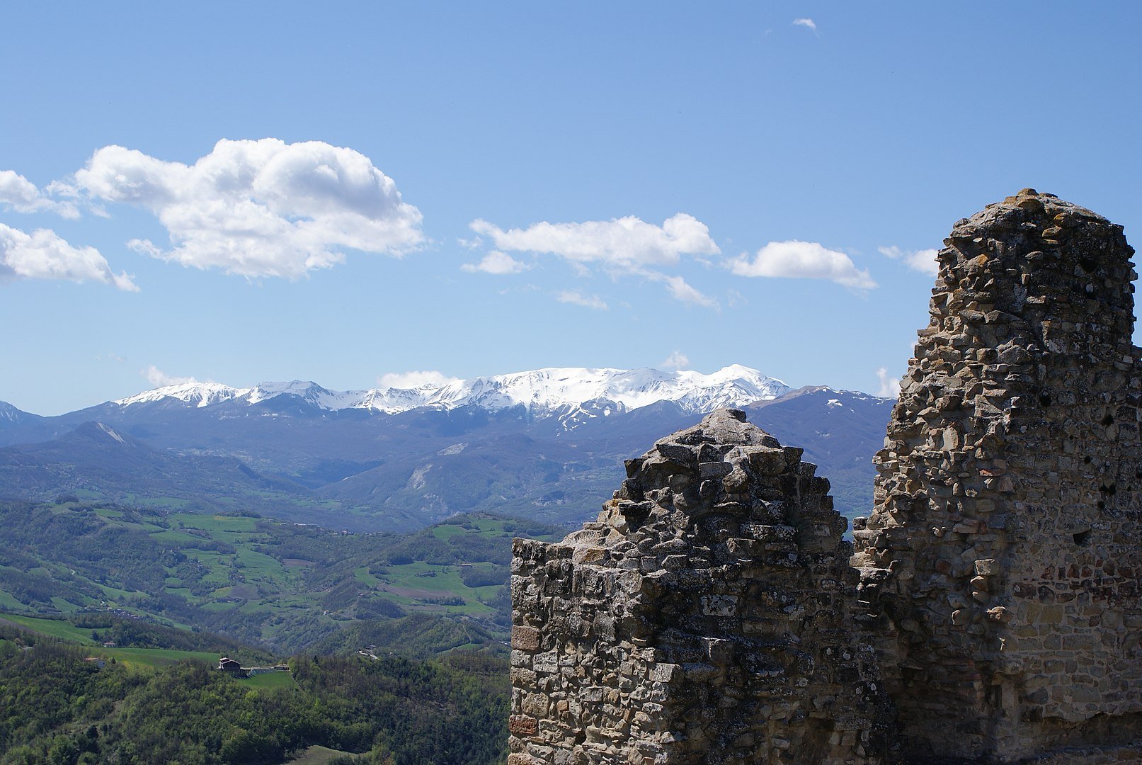
Cusna Mount seen from Carpineti Castle | Ph. Paolo Picciati
In 1451 a large part of the upper Dolo Valley, on the Reggio hills, was sold to the Duke of Este in exchange for tax privileges: the residual mixed forest of white fir and beech was called so Ducal or Royal Fir Wood for 4 centuries and was mainly exploited as the woodshed of the Duchy.
After more than a century of private ownership, it has been part of the regional state property for 30 years and is today a true green lung rich in history and culture inserted in the evocative scenery of the Tuscan-Emilian Apennine National Park.
The itinerary has a ring route that touches three refuges, up to the historic pastures overlooking the Val d’Ozola, between the Prado and the Cusna Mounts, with some slightly more adventurous variations and follows the routes marked by the CAI n° 605 – 605A – 633 – 631.
The “Abetina Reale” itinerary is today a fascinating trek suitable for all types of walkers that winds along the ridge of the Tuscan Emilian Apennines touching a maximum altitude of 1772 meters above sea level.
Technical specifications
Length: about 9 Km
Difficulty: E
Recommended Season: from June to November.
Author

Walter Manni
Explorer and Adventurer: loves sailing the oceans, climbing the highest mountains and surfing on the waves of the web
You may also like
Hiking Emilia-Romagna: 5 trails you cannot miss
by Walter Manni /// February 24, 2020
by Walter Manni ///
Slow Tourism in Emilia Romagna
by Elisa Mazzini /// January 21, 2019

Interested in our newsletter?
Every first of the month, an email (in Italian) with selected contents and upcoming events.
5 natural spots to discover in Emilia-Romagna
by Elisa Mazzini /// September 19, 2016
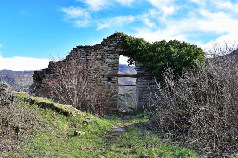
Discovering the forgotten villages of Emilia Romagna
by Walter Manni /// January 30, 2017
Hiking Emilia-Romagna: 5 trails you cannot miss
by Walter Manni /// February 24, 2020
by Walter Manni ///
Slow Tourism in Emilia Romagna
by Elisa Mazzini /// January 21, 2019
5 natural spots to discover in Emilia-Romagna
by Elisa Mazzini /// September 19, 2016
Discovering the forgotten villages of Emilia Romagna
by Walter Manni /// January 30, 2017
Charlotte elmroth
Interessante, mi piacerebbe avere ancora notizie sulla vostra regione.
Grazie