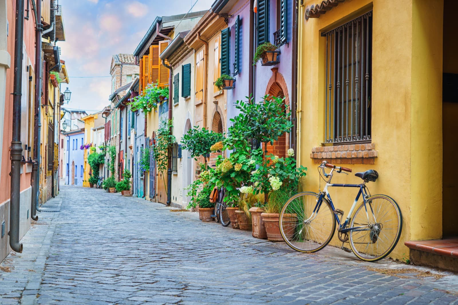
 Nature & Outdoor
Emilia-Romagna is not just about art and food. In this land that goes from the Adriatic Sea to the Apennines, you will find some of the rarest ecosystems in Europe and a network of natural parks made up of 2 national parks, 1 interregional park, 14 regional parks and 15 natural reserves!
Among the many landscapes that you can discover from the wetlands of the Po Delta Park to the mountain peaks of the Apennines, here are 5 spots that you must visit if you want to enjoy nature in Emilia Romagna.
Comacchio Valleys
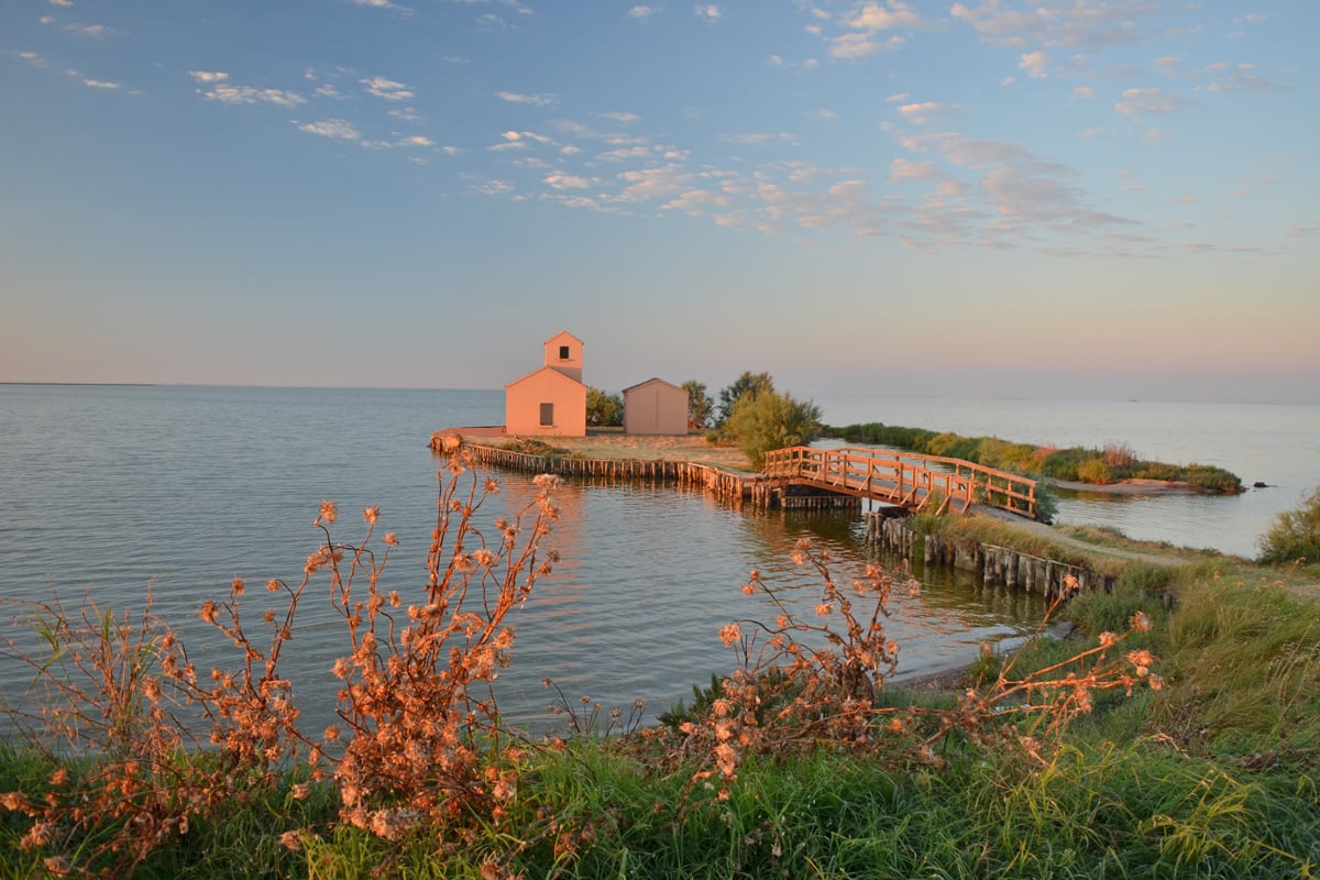
Central station of the Po Delta Park, the Comacchio Valleys are composed of sheets of water that cover more than 13 thousand hectares and are home to a wide variety of bird species.
Not only are they home to seagulls and terns, but as many as nine species regularly nest here and many other very rare species have chosen this lagoon area as their ideal breeding habitat. For example, the largest Italian colony of flamingos and the only Italian colony of spoonbills are based in the Comacchio Salt Pan.
The Foce Fishing Station – which hosts the Museum of the Valleys and the “lavoriero” used for fishing eels – is the perfect starting place for picturesque routes to explore the valleys by boat or foot.
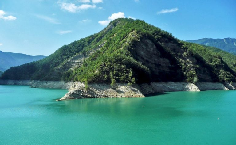
Ridracoli Lake
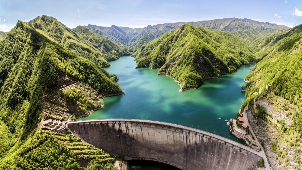
The lake of Ridracoli, created by the Ridracoli Dam of the Bidente River, is a perfect example of balance between human engineering and natural environment.
It is located in the town of Bagno di Romagna, on the Apennines in the Forlì-Cesena province. The lake is at 557m above sea level and it covers an area of 1.033km2.
A corner of paradise in the Casentino National Park, which offers many opportunities for recreation and physical activity, from boat trips to all kinds of hiking itineraries, such as the walk that from Rifugio Ca’ di Sopra reaches the Lama Forest, unpolluted green lung of the Park.
Roccamalatina Rocks
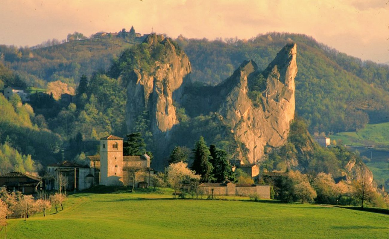
The park of Roccamalatina Rocks covers an area of 2.300 hectares on the Middle Apennines of the Modena province, in the municipalities of Guiglia, Marano sul Panaro, and Zocca.
A landscape of hills and mountains, made up of ancient chestnut groves, woods, karsts and medieval villages, which rises from 174 metres above sea level at the bottom of the Panaro River valley to 808 metres above sea level at Monte della Riva.
Among the many points of natural and cultural interest, the sandstone spires of Roccamalatina and Sant’Andrea Rocks.
With over 100km of trails, the park offers many itineraries accessible on foot, horseback or bicycle.
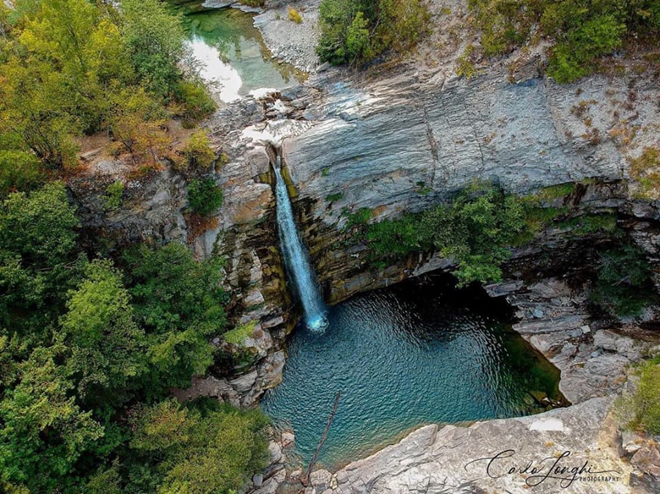
Dardagna Waterfalls
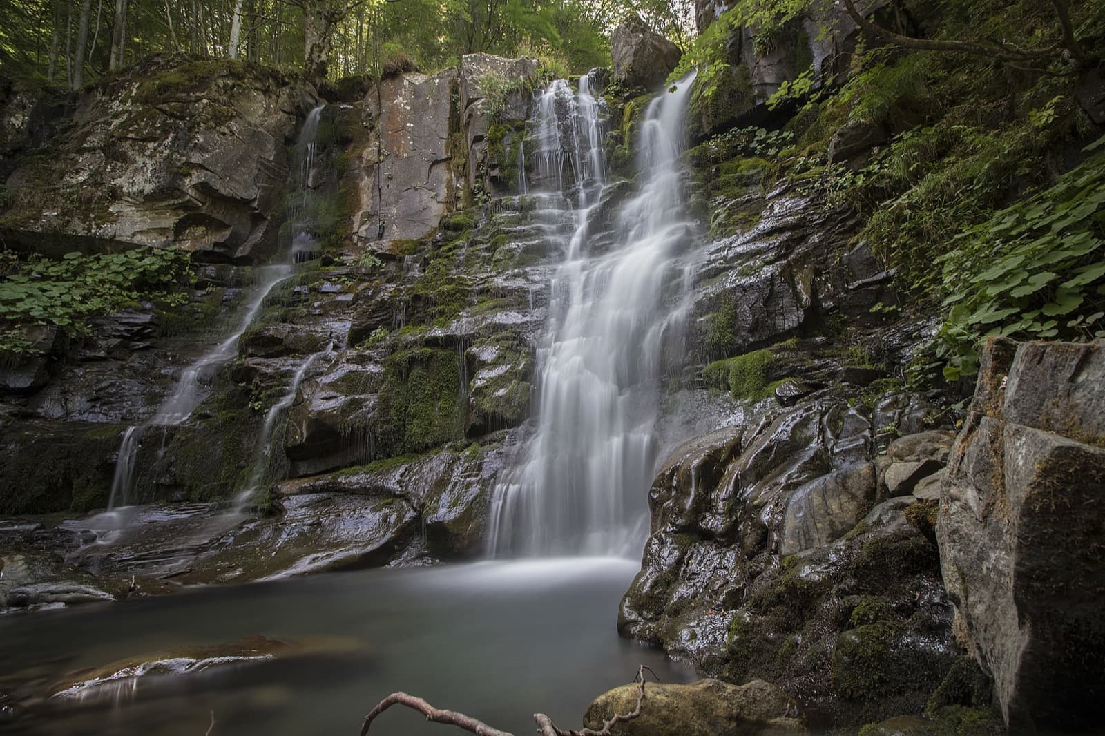
The Corno alle Scale Regional Park, named after the highest peak of the Bologna province Apennines, is a park that protects a precious territory made up of a complex variety of flora and fauna.
Inside the park, the imposing peaks that create the striking Valleys of the Dardagna and Silla Rivers rise high above the rest.
The Dardagna river has its source in the Cavone basins and flows into two distinct streams: the main one (to the east) descends from Corno alle Scale, while the secondary one (to the west) falls from Monte Spigolino in a series of charming waterfalls.
The Dardagna Waterfalls are undoubtedly one of the most popular natural features of the area. Tou can easily reach them in just a few hours with a scenic loop trail, suitable for everyone. The route starts from the Sanctuary of the Madonna dell’Acero.
Lake Santo Parmense
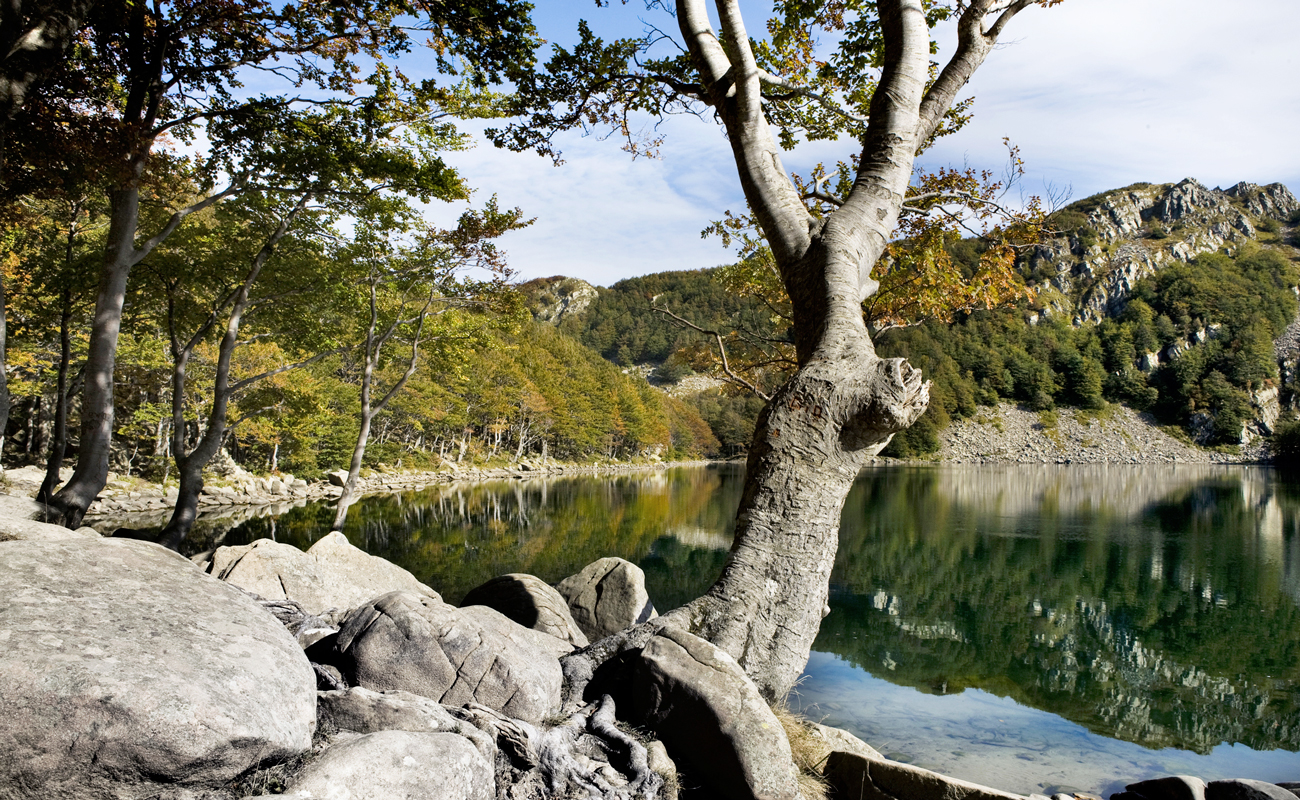
Lake Santo Parmense, with its depth of 22.5m, is the largest glacial lake in Emilia-Romagna as well as the largest natural lake of the Northern Apennines.
Located in the municipality of Corniglio, the lake is found in the western part of the Tuscan-Emilian Apennines National Park and is part of the Regional Park of 100 Lakes.
This lake is easily accessible from Rifugio Lagdei with a chairlift. You can also reach it on foot by following the easy path 723A, which takes less than an hour to Rifugio Mariotti.
This is also the starting point for the 2nd stage of the Alta Via dei Parchi trail. It’s a long walk that leads to Prato Spilla along the “Lake Ridge”, a suggestive succession of glacial valleys, rocky ridges and grasslands.
Author
Elisa Mazzini
Social Media Manager for @inEmiliaRomagna and full-time mom.
You may also like
5 hikes to discover the Casentinesi Forests on foot
by Elisa Mazzini /// October 19, 2020
by Elisa Mazzini ///
by Elisa Mazzini ///

Interested in our newsletter?
Every first of the month, an email (in Italian) with selected contents and upcoming events.
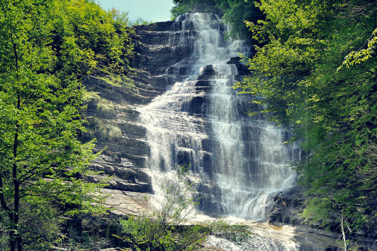
1. The most beautiful waterfalls in Emilia-Romagna
by Elisa Mazzini /// March 29, 2018
by Elisa Mazzini ///
by Elisa Mazzini ///
5 hikes to discover the Casentinesi Forests on foot
by Elisa Mazzini /// October 19, 2020
by Elisa Mazzini ///
by Elisa Mazzini ///
1. The most beautiful waterfalls in Emilia-Romagna
by Elisa Mazzini /// March 29, 2018
by Elisa Mazzini ///
by Elisa Mazzini ///