 Nature & Outdoor
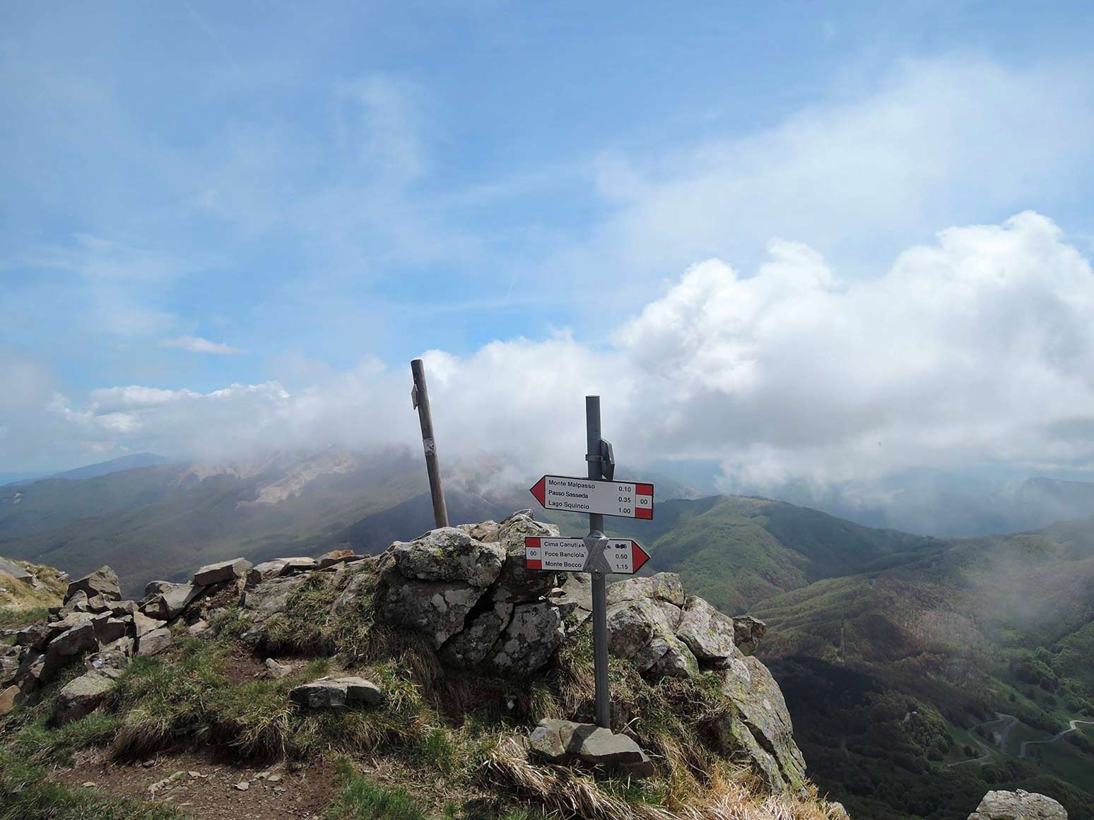
The Alta Via dei Parchi trail is 340 miles long. Crossing eight National Natural Parks on the mountans between Emilia-Romagna, Tuscany, and Marche, the trail consists of 27 stages that will help you discover the flora and fauna of the Italian Apennines.
Featuring well-equipped paths and shelters, we could define it a big open-air gym where hikers of all levels can appreciate the beauty of the Italian mountains.
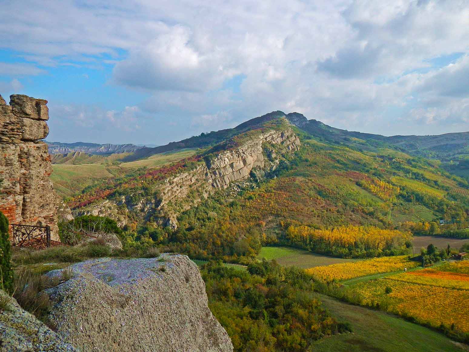
Discover the nature and culture of one of Italy’s most fascinating mountain areas, on the border between continental and Mediterranean climates.
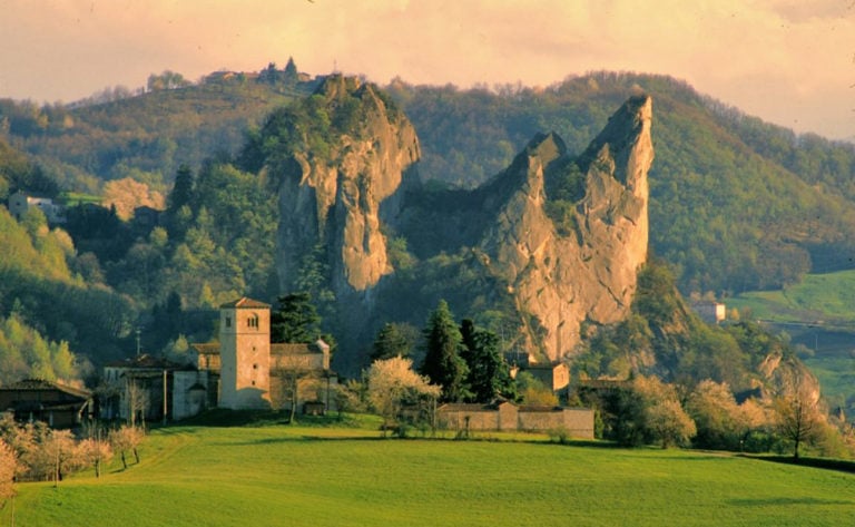
Glacial cirques, lakes surrounded by meadows, endless forests and torrents, volcanic cliffs and gypsum crags: not only is the Alta Via a way to experience the Apennines, but also a chance to slow down and enjoy its marvellous landscapes.
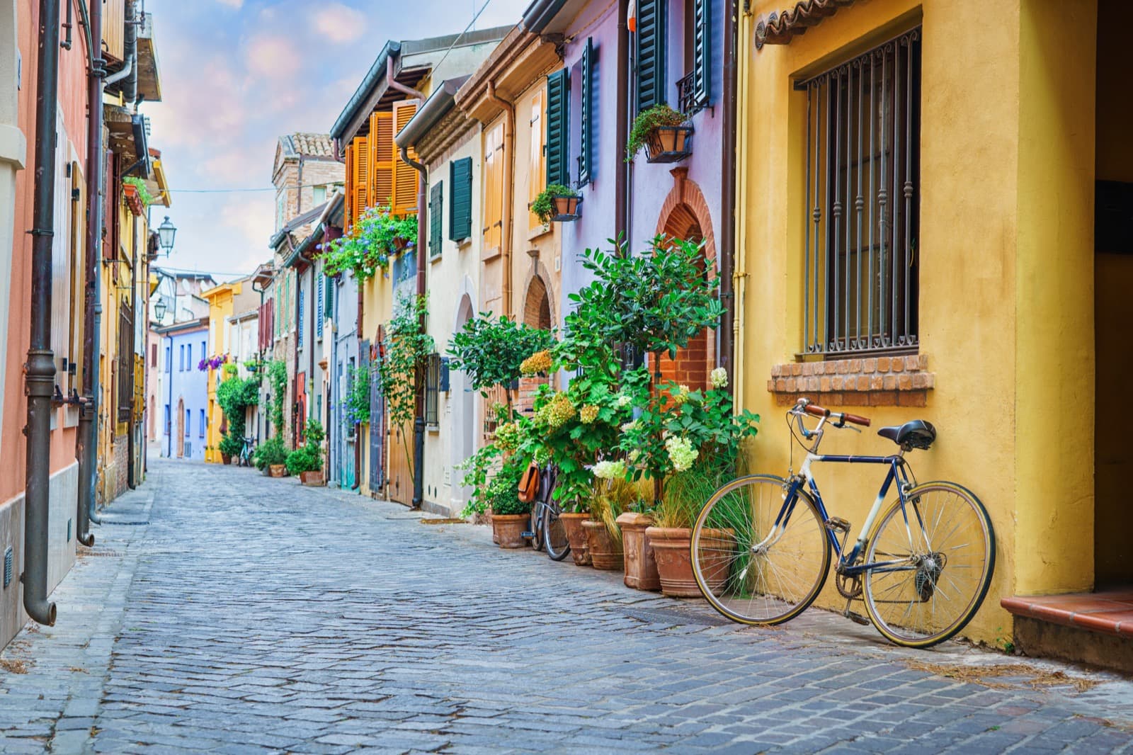
The beauty of nature is not the only thing to be seen on the trail. The route is dotted with humpback bridges, monasteries, abbeys and hermitages, as well as traces of the past left by peasants living in the harsh mountain environment: ruined houses and stables, shelters for woodcutters and shepherds, charcoal pits and ancient chestnut groves.
Remains of a civilisation that used the Tuscan-Emilian Apennines as a gateway to reach other sites in the Italian peninsula, and as a source of livelihood.
Hiking along the Alta Via dei Parchi Trail today is an opportunity to retrace the history of a traditional mountain economy, now disappeared, thus leaving vast uninhabited areas behind.
The route can be either walked entirely or in stages, only for a few days for example. Those who prefer the latter option should download the trail brochure including the map of the entire route, the detailed cartography of every stage, and accommodation.
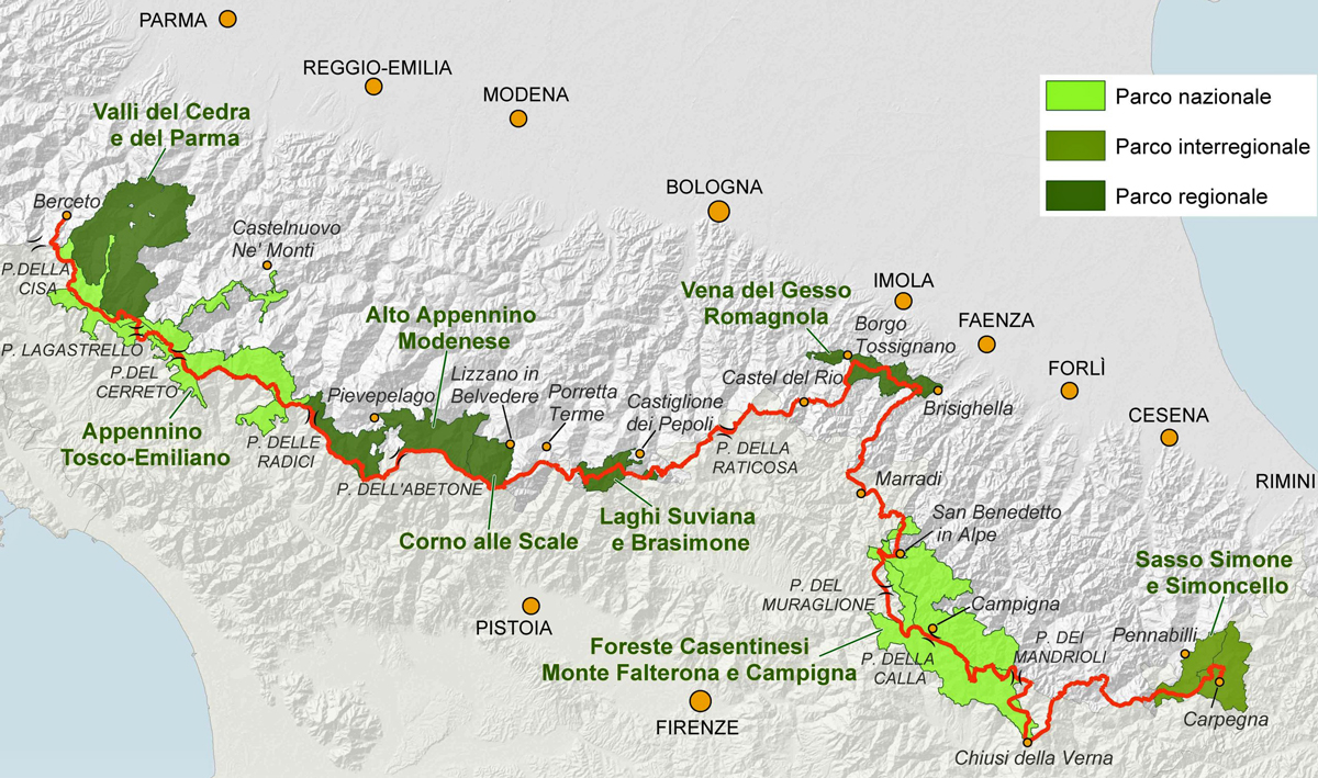
Those who love to combine nature and technology can take advantage of the free GPS tracks of the entire trail. If you wish to check out the route from home before leaving we suggest you access the dedicated website where you can also find the cycling paths, and take a look at the connections with public transport along the entire path too.
Alta Via dei Parchi is also part of the Hiking Europe project which led to the development of 6 tourist routes thanks to the collaboration with the Italian National Parks.
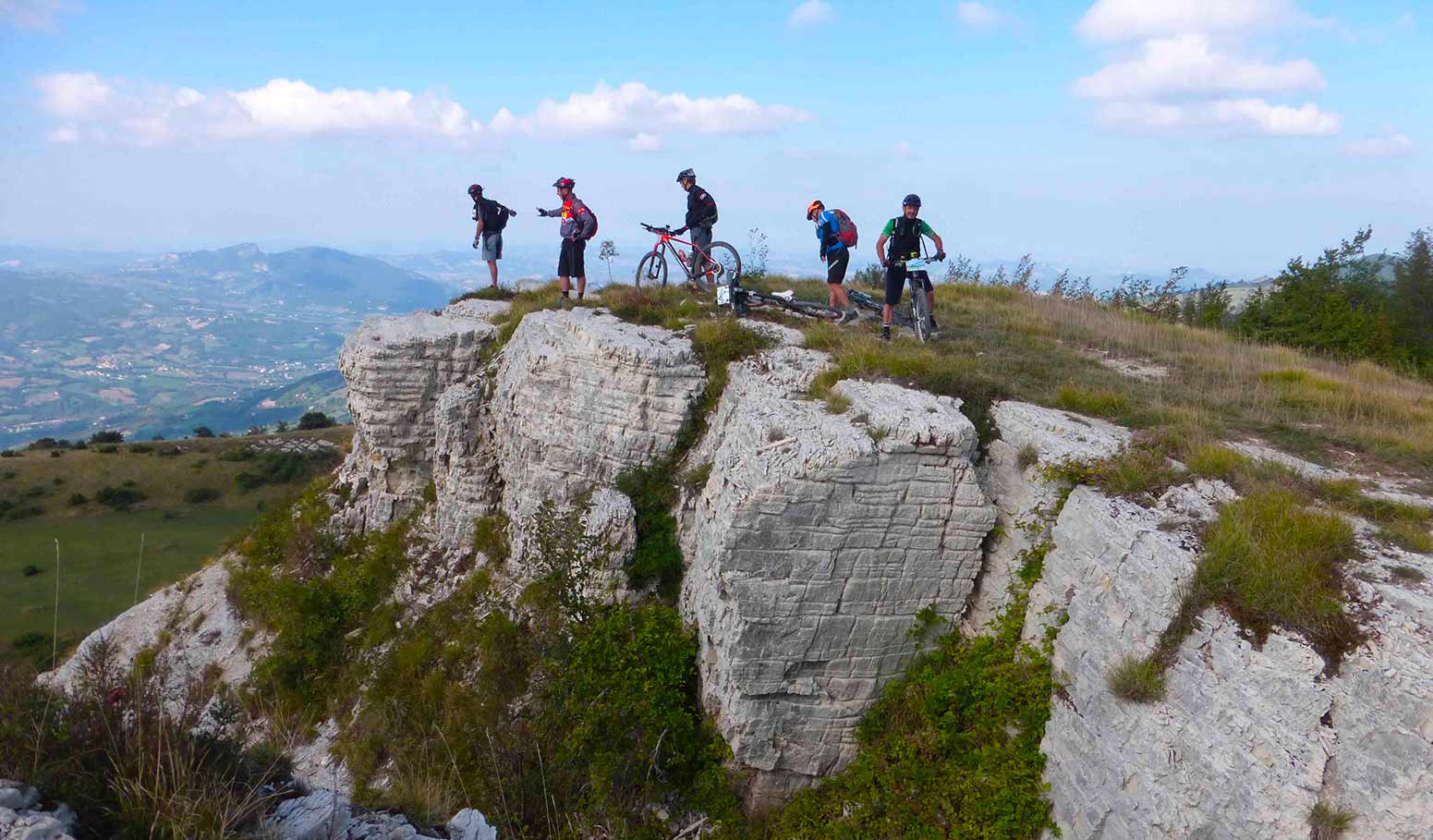
MTB enthusiasts will be happy to know that the Alta Via dei Parchi Trail is also suitable by bike thanks to local cycling groups who created a path specifically for bikes.
A magnificent 417-mile-long path, to be covered in 28 stages. The route can also be covered by train, which makes it easy to reach the starting and ending points as well as a couple of intermediate spots along the route.
If you love silence, nature and can’t wait to escape the city; if you like to sleep in unpolluted places, far from inhabited areas, cellular networks and the comforts of city life, Alta Via dei Parchi Trail is definitely the right experience for you.
Author

Walter Manni
Explorer and Adventurer: loves sailing the oceans, climbing the highest mountains and surfing on the waves of the web
You may also like
by Walter Manni ///
5 natural spots to discover in Emilia-Romagna
by Elisa Mazzini /// September 19, 2016
by Elisa Mazzini ///

Interested in our newsletter?
Every first of the month, an email (in Italian) with selected contents and upcoming events.
by Elisa Mazzini ///
by Elisa Mazzini ///
by Walter Manni ///
5 natural spots to discover in Emilia-Romagna
by Elisa Mazzini /// September 19, 2016
by Elisa Mazzini ///
by Elisa Mazzini ///
by Elisa Mazzini ///