 Art & Culture
O book, leave for Rome: if they ask you where you are from,
you will say from the region of the via Emilia.
(Martial, Epigram, III, 4)
Everyone knows it, everybody crosses and runs over it when travelling. But what do we really know about the history of Via Aemilia?
Via Aemilia is not only one of the most important consular Roman roads, but it is an ancient route that gathers together multiple aspects and features. First of all, it was such a useful street engineering work that it marked a whole territory, like that of Emilia Romagna. Second: it was a fundamental military work along which Romans could extend the conquest and colonisation of Northern Italy during the Republican Period. Third: it was an extraordinary experiment of urban design, among the first in which Rome succeeded for being that systematic.
Starting from all this, you will find a list of 10 fundamental aspects, which are useful for understanding the importance of this artery that for over 2000 years has been crossing and organising the territory of Emilia Romagna together with its cities, landscapes, peoples and cultures and that has been marking and shaping the history of this land over the millennia
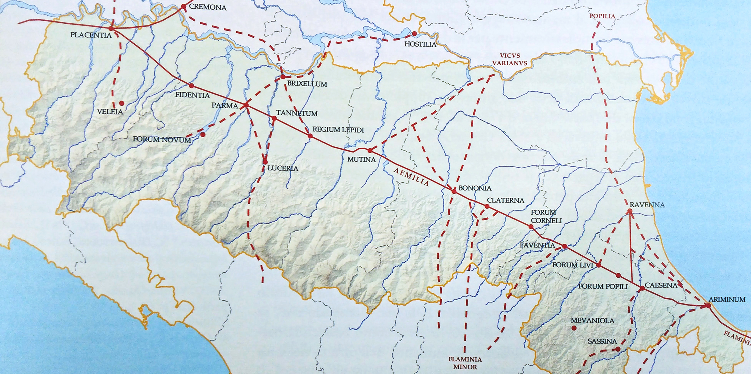
The path of Via Aemilia through the Emilia Romagna | Photo © www.3d-virtualmuseum.it
- The construction of the road began in 189 B.C., 16 years after the Peace Treaty with Carthage and the end of the Second Punic War. The end of any war and any resistance along the Southern border of the Empire lead to a period of calm that allowed the Romane Senate to arrange the organisation and colonisation of Emilia Romagna
- The mind of all this was Consul Marcus Emilius Lepidus (from which stems the name of the road), who would have certainly preferred to deal with the Asian provinces since he knew them better and he had already fought in those territories. Unfortunately for him, this did not happen. However, he was able to design and build Via Aemilia following the general military logic and making it a defensive bastion, most of all, as protection from the East (at the Eastern borders the Macedonians were putting pressure)
- The Aemilia region hasn’t changed much over time: not only its name but also its borders are quite the same. Unlike all the Roman properties of the Italian Peninsula – except for the ancient Flaminia that once counted the current regions of Umbria and Marche, Aemilia is the only region to stem his name from a street
- Via Aemilia was built, over a pre-road system dating back to the period before the Roman Kingdom. Its layout retraced connections of old previous settlements created by time and bypassers that travelled from the Adriatic Sea to the Tyrrhenian Sea and vice-versa
- Around 218 B.C. Romans officially started the foundation of colonies in the region of Aemilia. Beyond the already mentioned Ariminum (268 B.C.), Placentia was one of the most important new colonies founded in this period. It was a strategic outpost meant to protect the Passage of the Apennines that led to the old Etruria and at the same time, it was the only remaining traversable crossing of the Po river
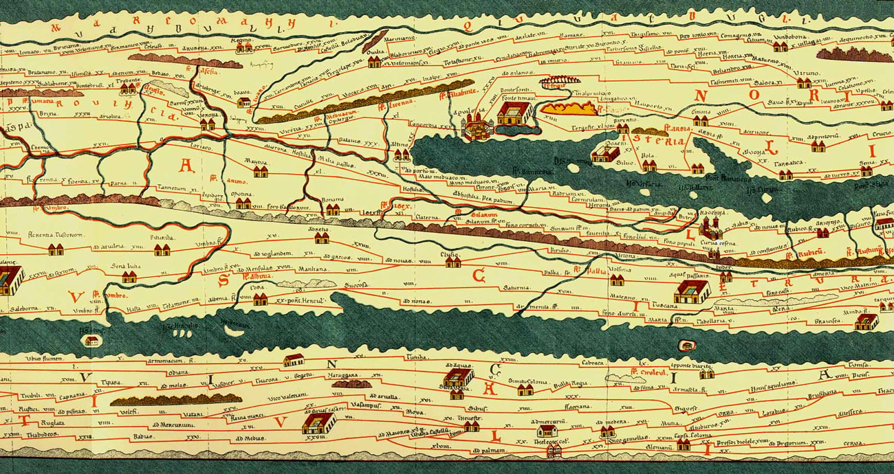
Via Aemilia in the Tabula Peutingeriana, an ancient Roman road map showing the road network of the Roman Empire (4th century AD)
- With 13000 stops for a total length of about 230 kilometers, Via Aemilia connected from South-East to North-West the extremes of the region: firstly, connecting the preexisting centres, such as Piacenza, Rimini and Bologna and secondly, forecasting new cities, such as Modena and Parma (183 B.C.) and Reggio Emilia (175 B.C.). Other important urban entities followed later as a consequence of its development, as today’s Cesena, Forlimpopoli, Forlì, Faenza, Imola – and a series of further little cities, which popped up spontaneously thanks to the uniting force of this consular road.
- If you pay attention to the position and the structure of the Roman colonies displayed along the Via Aemilia (Placentia, Mutina, Bononia, Forum, Populii, Ariminum) it is clear that they were not only stops, but they also worked as a control barrier for any main access to the Apennines.
- The colonisation of the Region never had the goal of purging the local populations as occurred in the Flaminia Region. Because of the Punic Wars, the Roman army saw huge losses of men in working-age. Thus, it was necessary to integrate the local populations of the new-born Roman colonies, giving them plots of land and limiting the big expropriations, which lead to a period of peace and loyalty from the locals.
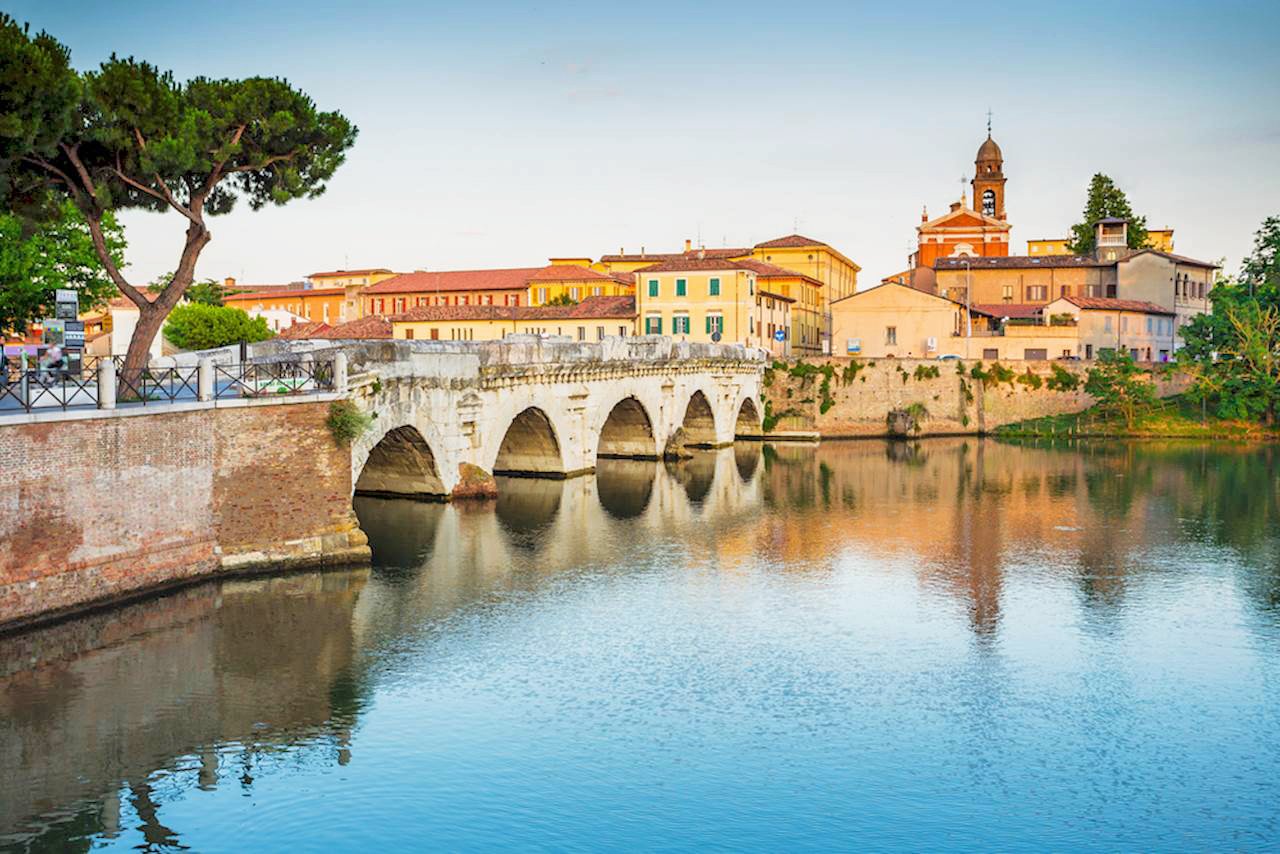
Rimini | Ponte di Tiberio
- 150 B.C. the local populations started deforestation and land reclamation activities throughout the area, which at that time should have looked like the today’s Mesola Wood. As a result of a huge collective effort and a cautious administrative campaign, a vast network of streets raised which is still visible if seen from above, from a plane for example.
The region Aemilia became so the workshop for the first centuriation works, the activity of land division into homogeneous plots destined to organise the lands into rational productive unities - Last but not least: the structure. Via Aemilia was built along raised banks in order to avoid natural obstacles along its track. In the urban centres, it was made of layers of stones floors or cobblestones with a sidewalk or small steps delineating its edges. Outside the cities, however, it was made of a heavy layer of gravel and river rocks. Some pieces are still visible and crossable, like in the case of the Bridge of Tiberius and in the undergrounds of Bologna, in correspondence with the Two Towers. Other traits of the original Via Aemilia come to light from time to time during renovation works.
- For a better orientation or to get precise information about the distance from a place to another, who travelled along the Via Aemilia could count on the so-called Miliari, stones originally placed at every mile (1476 mt) and that, with some frequency, also reported the name of the authority responsible for the maintenance or for the renovation works of the road system. By now, more than thirty milestones are known, some of them have been left in situ, other are displayed in some city museums, some others have been reused in some later constructions, like the one inserted in the shaft of the column inside the little Church Pieve di San Giovanni in Brisighella.
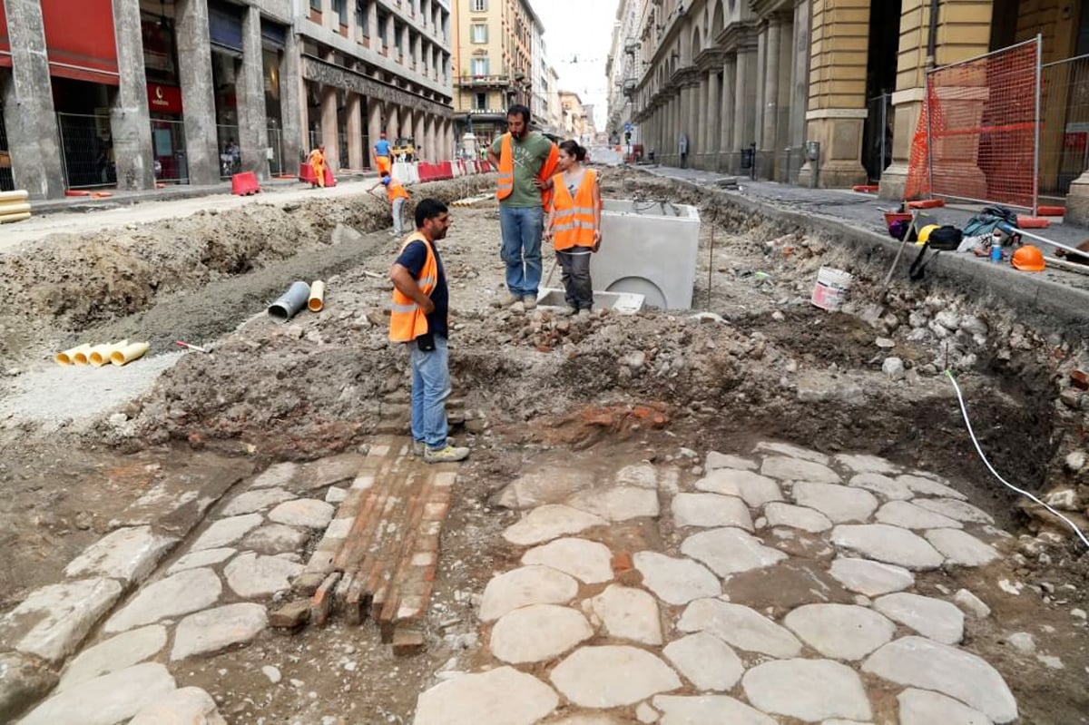
Via Aemilia | Archaeologica excavations in Bologna
Author

Davide Marino
Davide Marino was born archaeologist but ended up doing other things. Rational – but not methodic, slow – but passionate. A young enthusiast with grey hair
Emilia
Here’s an Emilia–and not a “via,” but a writer and lover or art and all things Rome and Egypt! Thank you for the wonderful article.
misbahul munir
good
Rosemary
Thank you! Interesting and useful information. Now I know more about where I am.
Carmine Mastrolia, M.D.
This is a beautiful article! Very accurate. I traveled on Via Emilia many times while I attended medical school in Parma, Italy. You brought back many memories of that lovely city and pleasant people. Thank you so much. I miss it so.
Bill Clay
The Via Emilia is amazingly straight, so deviations are very obvious. One of the most noticeable is Ponte S. Ambrogio SE of Modena, probably due to this being the least difficult point at which to bridge the Fiume Panaro. But was that the case when the Via Emilia was built, or a later adaptation as the Panaro meandered? Do you know of any historical records of the original route in this area or of later relocations following floods or other disasters?
Elisa Mazzini
Unfortunately, we don’t have any specific information to answer your question.
Best regards,
Elisa